3 wintry hikes near L.A. to peep pine trees (and maybe snow)
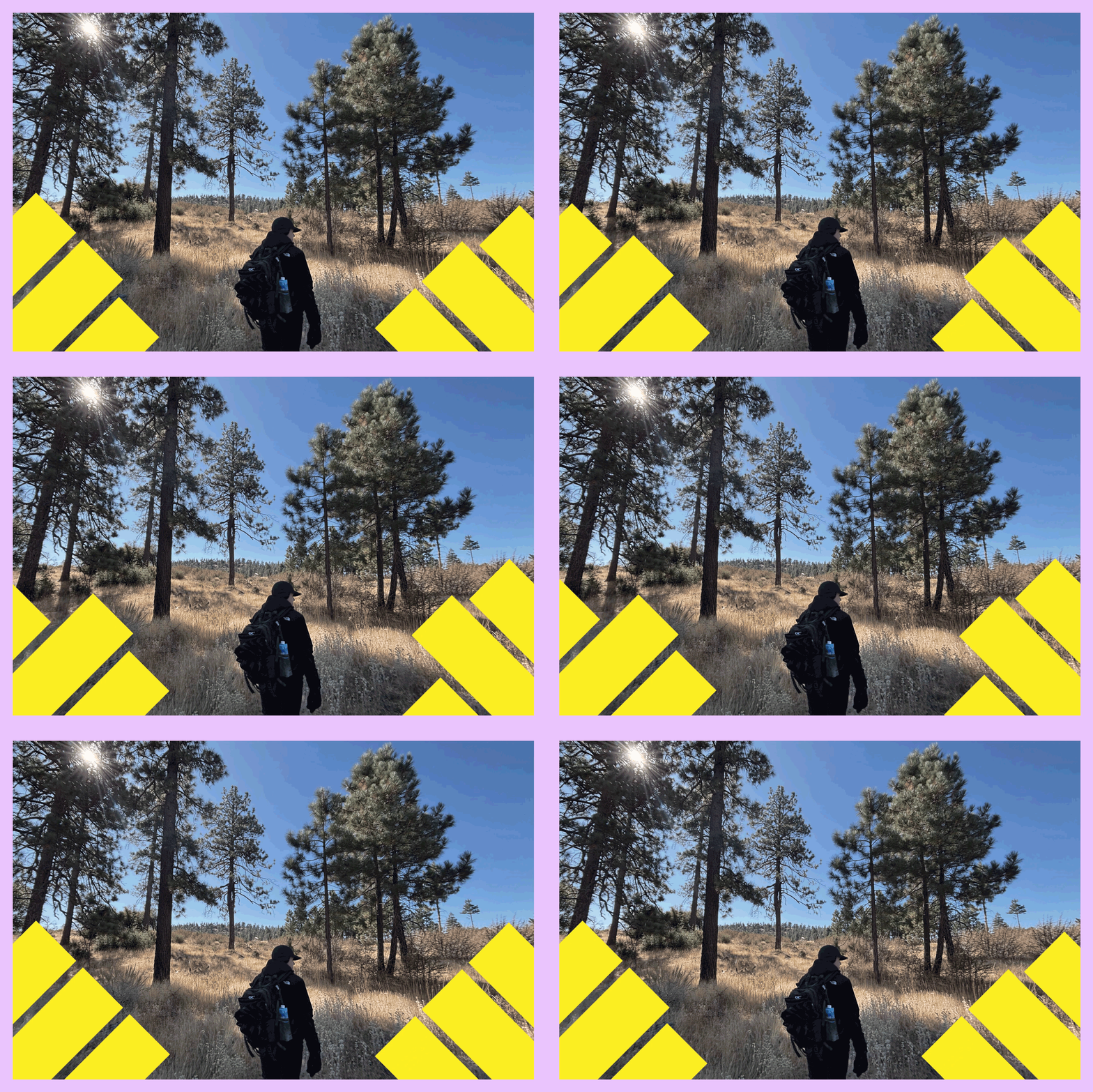
This chilly time of year, it always feels like I’ve stepped through a portal after I drive 45 minutes from L.A. and find myself alone with my dog in a winter wonderland.
I love studying the snow to read the stories it tells in the animal tracks, like those left by a galloping deer. Was it running from something? Occasionally I spot a mountain lion print.
You are reading The Wild newsletter
Sign up to get expert tips on the best of Southern California's beaches, trails, parks, deserts, forests and mountains in your inbox every Thursday
You may occasionally receive promotional content from the Los Angeles Times.
California is home to more than a dozen species of pine trees and has some of the largest, tallest and oldest conifers in the world, according to the California Native Plant Society. That includes the largest sugar pine in the world, which is also the largest known pine tree in the world.
So I put together a list of three of my favorite trails that showcase this spellbinding ecological diversity. It remains unclear how much precipitation Southern California will get this winter. Regardless, it’s a beautiful time to head out and enjoy the pine forest in brisk winter temperatures and breathe in the classic smells of the holiday season.
The hikes below don’t feature any world record holders — at least for now — but they will instill you with awe as you meander beneath a variety of large pines.
Before heading out, make sure to check the weather and road conditions. Depending on the amount of ice and snow, you might need additional footwear. Microspikes are best for light hiking while crampons are helpful on more technical trails. And don’t forget to pack your trekking poles!
That said, I hope you have a great time experiencing winter in our backyard.
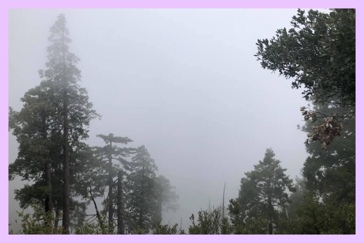
1. Icehouse Canyon to Icehouse Saddle
Distance: 7.2 miles
Elevation gained: 2,600 feet
Difficulty: Challenging
The 7.2-mile trail through Icehouse Canyon to Icehouse Saddle is, in my humble opinion, one of the most beautiful trails in Southern California. Winding through a shady canyon, you’ll notice big cone Douglas fir, California incense cedar, white alder, California bay and several types of pine trees, including the Jeffrey, lodgepole and sugar pine trees. It also features large boulders where hikers regularly take a rest break.
I’ve hiked this trail in every season. In the spring, once the snow melts, it’s a blissful paradise. It features numerous short waterfalls and deep blue pools of clear, cold water. In the summer, it is much of the same — and the water actually feels good after a hot hike. In the fall, it’s easy to spot fall foliage in the canyon. And in the winter, this hike often gets some level of snow — including significant enough amounts that it’s not safe to hike the trail unless you have microspikes, crampons, an ice axe and other important mountaineering gear (especially if you plan to travel beyond the saddle to any nearby peaks). (When in doubt, call the ranger’s station.)
The trail is an out-and-back. The halfway point is the saddle, where you’ll find trails leading to Cucamonga and Ontario peaks, among others. You’ll also have great views of the canyon below and more.

I have so many memories on this trail. Once while taking a snack break, my friend and I heard rocks moving on a nearby hillside and soon spotted three bighorn sheep. Another time, I was with two friends and it was supposed to stop raining by 10 a.m. It did not, and by the time we reached the saddle, we were drenched enough to look like we’d gone swimming with our clothes on. That was the day I learned you have to re-waterproof your gear.
Each time I go, it’s a new adventure on an old trail. I hope you walk away with great memories too!
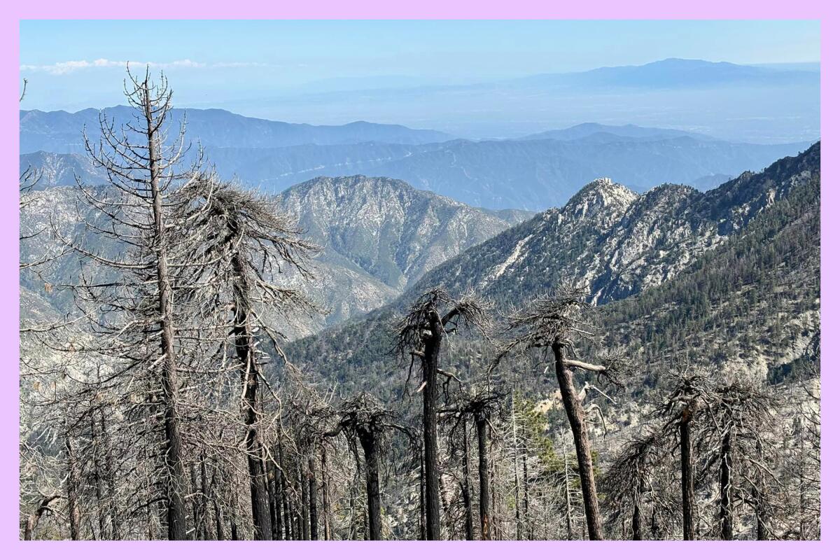
2. Mt. Waterman Loop
Distance: Six miles
Elevation gained: About 1,400 feet
Difficulty: Moderate
The Mt. Waterman Loop takes you just under six miles through Angeles National Forest, where you’ll get sweeping views of both Los Angeles and, on the other side of the mountains, the Antelope Valley. You’ll travel under the shade of pine trees and, in the right season, spot native wildflowers, including the funky red snow plant.
To start, park at the Buckhorn Day Use area or the large parking lot just north of it. I usually start my hike at the white gate kitty-corner to the day use area. After passing through the gate, you’ll walk south on the fire road for about 400 feet before finding the trail.

You can take the loop in either direction, but I prefer to take it clockwise because the southern half of the loop takes you through a forested area with more shade. My dog, Maggie May, and I had a lot of fun playing in the snow this past May in this area.
The northern half is more of a fire road. The main benefit of taking the fire road, outside of its simplicity, is that you’ll walk only two miles before reaching the ski lodge area, where the restrooms are usually unlocked. Flush toilets in the middle of the woods — what a treat! If you take the foresty half of the loop, you’ll reach this area after about 3.8 miles.
At the top, enjoy sweeping views and the chattering of chipmunks amid the solitude of this trail deep in the woods.
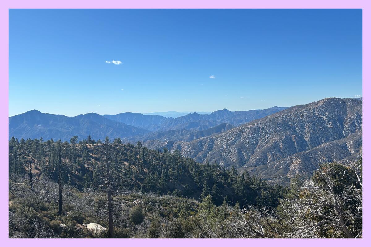
3. Mt. Hillyer via the Silver Moccasin Trail
Distance: About six miles
Elevation gained: About 1,200 feet
Difficulty: Moderate
This six-mile jaunt along the Silver Moccasin Trail — which is 53 miles when fully open — is a gorgeous mix of high desert and pine trees. Shaped like a lollipop, the trail starts near the Chilao Visitor Center and takes you through forest and boulders, the fresh scent of pine following along the way.
If taking the trail counterclockwise, you’ll pass the Bandido Group Campground about 1.5 miles in. It has a few vault toilets. If lucky, you’ll be greeted by horses, as this campground has several corrals. Keep an eye out for Jeffrey pines, which provide shade around the site. From here, the trail is paved until you reach the Rosenita Saddle. You’ll soon be greeted by tall ponderosa and sugar pines.
The trail also features Coulter pines that produce massive cones nicknamed “widowmakers” because of their size. The Coulter pine cones can weigh up to 11 pounds! That’d be like getting hit in the head by a spiny house cat! So, if you’re in the area when it’s windy, please watch your head.
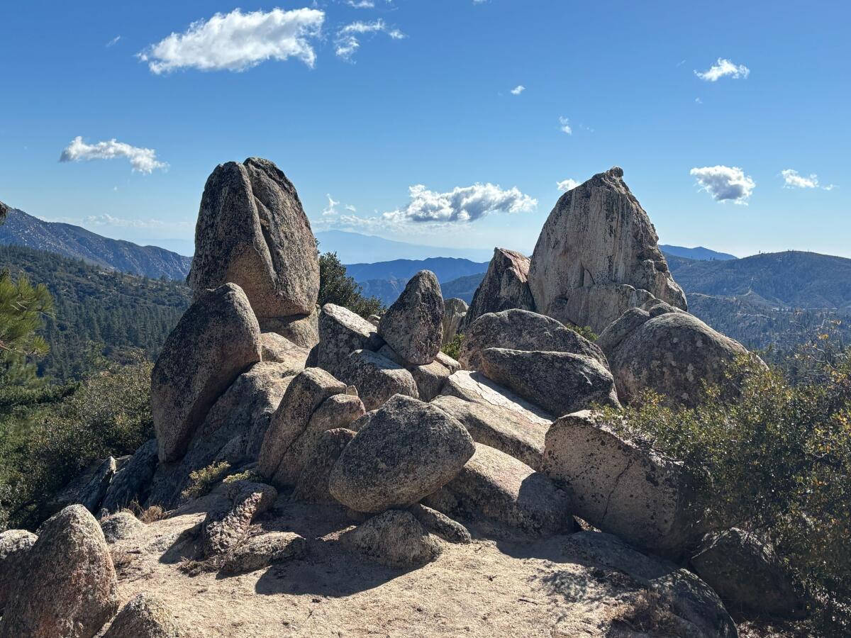
To reach Mt. Hillyer, you’ll turn left about three miles in. The summit features several boulders that are a blast to scramble along. It’s a great spot to pause for lunch, one where you have a view of dense forest and other peaks, including Santiago Peak, the highest point in Orange County.
While out hiking the trail, my friend and I spotted few people, outside of a few rock climbers checking out the bouldering scene. As a bonus, when my friend Mish and I hiked it in mid-November, we hiked through light snow dust.
***
When recommending hikes in The Wild, I usually try to pick an easy, moderate and hard trail. That was more challenging this week, in part because of the regional closures from the Bridge and other fires. If these trails are a bit outside your hiking abilities, there’s still a great spot to visit: the Berlin Forest in Griffith Park is a healthy stand of pine trees near the Griffith Observatory. You could park near the observatory or take the shuttle bus there, and then walk 1/10 of a mile from the parking lot to the forest. My friends recently viewed the full moon from there and had a great time. There are multiple paths to the forest, which honors Berlin — one of L.A.’s sister cities.
If you know of a great trail to enjoy our native pines, please let me know. I’d love to include it in a future edition of The Wild!

3 things to do

1. Traverse 5 miles of closed streets in the San Fernando Valley
CicLAvia will host its final open streets event of the year from 9 a.m. to 3 p.m. Sunday in the west San Fernando Valley. This free event will close five miles of Sherman Way so visitors can travel by foot or on wheel through Canoga Park, Winnetka and Reseda. The event is always free, and participants can show up anywhere along the route to walk, jog, bike, roller skate, skateboard or simply people-watch from a comfy stoop. Outside of motorized wheelchairs, only people-powered vehicles are allowed. For restrictions on electric bikes, visit the website. Learn more at eventbrite.com.
2. Paddle with pals in Long Beach
Anyone with a paddleboard or kayak is welcome to join others today from 5 to 7 p.m. for a sunset paddle of Alamitos Bay in Long Beach. Organized by local Realtor David Sanchez, the group will begin in the bay, paddle through nearby canals and around Naples Island before returning to the starting point. All skill levels are welcome, but you must be able to paddle when it gets dark. You won’t be able to rent a paddleboard or kayak, as rental shops are closed by the time the event starts. Participants are also encouraged to bring a headlamp or other light, life vest/belt and leash. Learn more at eventbrite.com.
3. Walk with hot people in Santa Monica
Hit the street at 9 a.m. Saturday at Dorothy Green Park (2600 Barnard Way, Santa Monica) for Hot Girl Walk For Good. The free event will raise money for the Downtown Women’s Center. For each attendee, Hot Girl Walk will donate $5 to the center. Participants who donate $20 or more will receive a Hot Girl Walk tote bag. The Hot Girl Walk was created in 2020 by Mia Lind, a USC senior at the time. Register at eventbrite.com.

The must-read

Every time I meet an older hiker on the trail, I ask them about their training regime. Time and again, the answer includes yoga. Recovery is an important part of anyone’s hiking routine, and lucky for you, The Times has published a list of the 28 best yoga studios in Los Angeles. We are in America’s yoga capital, making it sometimes overwhelming to find the right studio. We visited every business on the list to ensure it met our expectations for quality, professionalism and overall atmosphere. We purposely left out corporate chains, not because they aren’t great, but because they’re easy to find. Instead, we focused on independent, locally-grown businesses that offer something unique. We wanted to introduce you to studios that make yoga as accessible as possible, whether that meant proximity, price or approach. We also included donation-only options, such as yoga at Hollywood Forever Cemetery.
It’s not a stretch to say you can use our list to find a studio that’s right for you.
Happy adventuring,

P.S.
Have you ever felt frustrated while reading trail reviews on an app because users shared minimal information outside of the trail’s aesthetics? Me too, my friend. That’s why I was excited when I found the newly launched Trip Report. It is a free user-generated repository where you can provide extensive detail — my favorite! — on logistics, conditions and more. It’s kind of like a simplified blogging platform for hikers. I enjoyed one parent’s report of an overnight backpacking trip with their toddler. The site can only be as good as its reports, so please consider sharing about your adventures in and around L.A!
For more insider tips on Southern California’s beaches, trails and parks, check out past editions of The Wild. And to view this newsletter in your browser, click here.
Sign up for The Wild
We’ll help you find the best places to hike, bike and run, as well as the perfect silent spots for meditation and yoga.
You may occasionally receive promotional content from the Los Angeles Times.


