Tropical Storm Barry bears down on the Gulf Coast

- Share via
Reporting from NEW ORLEANS — This low-lying Louisiana city — built on a crescent-shaped sliver of land surrounded by the mouth of the Mississippi River, Lake Pontchartrain and the Gulf of Mexico — has long battled water.
But Tropical Storm Barry presents a somewhat unusual threat.
While tropical storms and hurricanes are a risk along the Gulf Coast throughout the summer and fall, Barry comes at a time when the Mississippi River is already swollen from unprecedented late-season flooding.
Normally, flooding on the lower Mississippi River subsides in May. But the wettest 12-month period on record in the contiguous U.S. has drenched the Midwest, so that the Mississippi River has been above flood stage in southern Louisiana for 187 days, beating a 1927 record by nearly two months.
The Mississippi is already more than 16 feet above sea level in New Orleans, according to the National Weather Service in the city. The levees that protect New Orleans from the river are between 20 and 25 feet high.
“Nowhere along the Mississippi River will the levee be overtopped, but this could be a very significant rain event,” Louisiana Gov. John Bel Edwards said at a news briefing Thursday in New Orleans. “And whether the water is flooding you, whether it comes from the sky or from the river, at the end of the day it doesn’t matter — it presents the same threat.”
While forecasters expect a storm surge of 3 to 6 feet across southeast Louisiana, in New Orleans it is expected to be about 3 feet, which means the river would probably peak at 19 feet on Saturday, keeping it from overtopping the levees.
Still, Edwards emphasized that much of southern Louisiana was still at risk of major flooding. Two low-lying coastal areas south of New Orleans — Plaquemines Parish and Grand Isle — are already under mandatory evacuations.
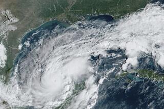
Poised to become the first tropical system to strike the United States this 2019 hurricane season, Barry could strengthen into a hurricane late Friday before hitting the Louisiana coast early Saturday, according to the National Weather Service.
It is also forecast to move slowly, dumping as much as 10 to 20 inches over southeast Louisiana and southwest Mississippi, with higher amounts in some areas.
“It has the potential to be a huge rainmaker,” said Phil Klotzbach, an atmospheric research scientist at Colorado State University. “That is the biggest concern.”
On Thursday afternoon, the storm was about 90 miles south of the mouth of the Mississippi River, moving west with maximum sustained winds of 40 mph. The National Hurricane Center issued a hurricane warning for a 150-mile stretch of the Louisiana coast, from Intracoastal City to Grand Isle.
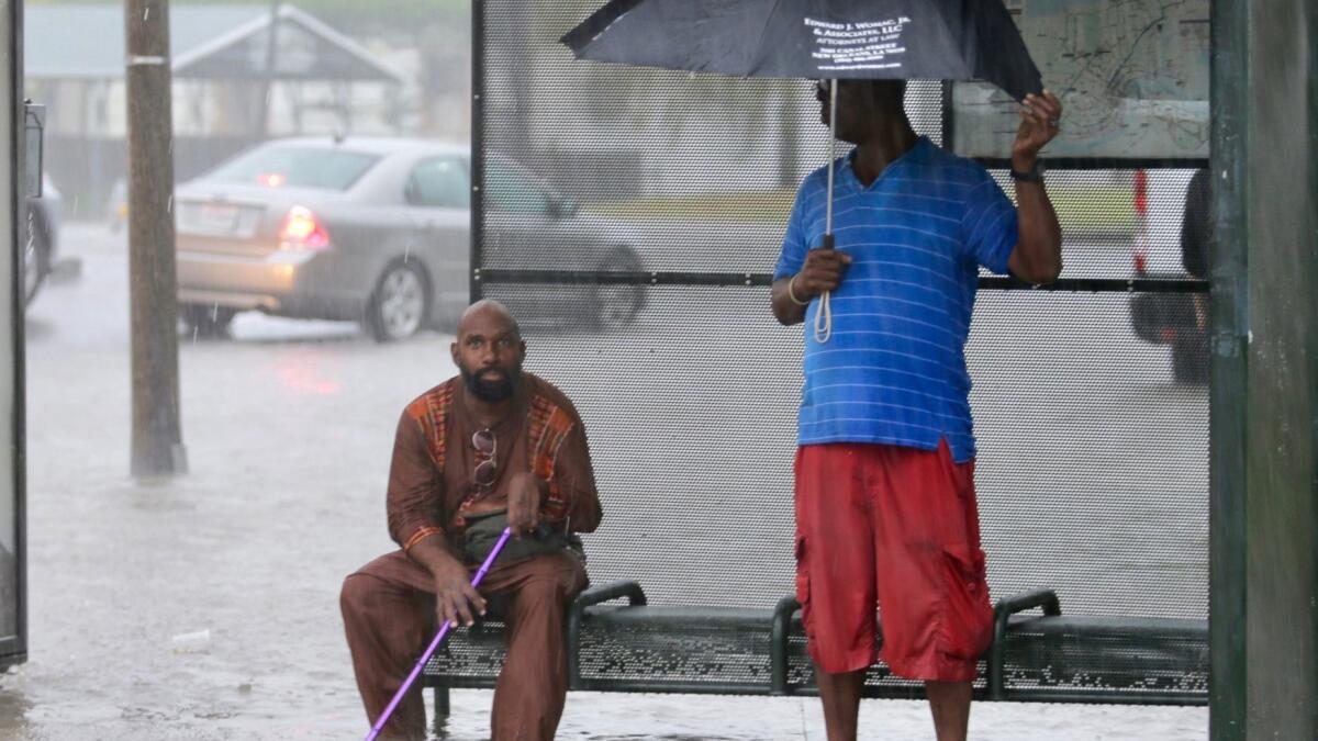
While the sky was blue Thursday and the sun shone through wispy white clouds, New Orleans got an inkling of what was ahead early Wednesday when heavy thunderstorms flooded streets across the metro area. Some historic neighborhoods, such as Treme, received more than 8 inches of rain in three hours. Water overturned garbage cans and submerged cars.
Uptown, locals paddled kayaks across Magazine Street, and in the central business district a man swam down Canal Street.
New Orleans’ leaders have yet to call for voluntary or mandatory evacuations, but they urged residents Thursday to prepare for the coming deluge by gathering emergency supplies: perishable food to last three days, three gallons of water per person, as well as a week’s supply of prescription medications, first aid kits, flashlights, batteries, matches, lighters and a radio.
Andy Horowitz, an assistant professor of history at Tulane University who is working on a history of Hurricane Katrina for Harvard University Press, said Barry did not have to constitute a particularly powerful storm with high winds for people to be on edge.
“People in New Orleans are increasingly aware of the city vulnerabilities — even if it’s not a major category hurricane.”
After Katrina flooded the Gulf Coast in 2005, leaving an estimated $151 billion in damage and more than 1,800 deaths, local, state and federal officials spent about $20 billion bolstering its levees, flood walls and pumps in an effort to protect the city from future storms.
“We’ve spent a lot of time, a lot of effort, over a year since last hurricane season, looking at this problem that is here today,” Col. Terry Ebbert, the city’s director of public safety and homeland security, said at a Wednesday media briefing.
“This is going to be an opportunity to show, I think, the public and the rest of the nation that we in New Orleans know how to deal with the problems that the weather brings to our shores.”
On Thursday afternoon, the Louisiana National Guard had begun to activate some of the extra 3,000 soldiers and airmen Edwards had authorized ahead of the storm. It had also staged high-water vehicles and boats in more than 20 communities across the state and positioned helicopters to support search and rescue, evacuation and recon missions as needed.
Clyde Cain, who founded the nonprofit Louisiana Cajun Navy/Louisiana Storm Patrol after floods in 2016, was in western Louisiana on Thursday, near where he expects the storm to pass east of Lafayette.
“I know personally we’re going to be doing a lot of rescuing,” Cain said. “There’s so many bodies of water that are so full right now, it’s hard to tell where it’s going to come from. I can’t say where, but I can say this: It will be historical.”
Morgan City Mayor Frank “Boo” Grizzaffi said the city ramped up preparations Thursday as the storm veered east, its track expected to pass directly over the rural town of 12,400 people.
“All of a sudden, we find ourselves in the worst quadrant of the storm, which is the northeast,” Grizzaffi said by phone from City Hall ahead of a visit from Edwards to survey local emergency management. No evacuations had been ordered, but residents were sandbagging.
Grizzaffi said his city was “well protected” from outside flooding, surrounded by 10-foot federal levees and flood walls. His concern was that, with more than 15 inches of rain expected in places, stormwater might accumulate inside the city.
“We can handle the first 5 inches. After that, 1 inch per hour before our system gets inundated,” he said. “Rising water don’t get us from the outside, but rain will get us from the inside.”
Jarvie reported from New Orleans and Boxall from Los Angeles. Times staff writer Molly Hennessey-Fiske in Houston contributed to this report.
More to Read
Sign up for Essential California
The most important California stories and recommendations in your inbox every morning.
You may occasionally receive promotional content from the Los Angeles Times.


