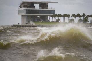
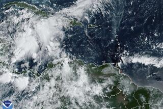
Hurricane season is about to start, and experts predict it will be busier than usual
FORT LAUDERDALE, Fla. — Message to residents on the East and Gulf coasts: Brace yourselves for a wet and worry-filled summer.
The National Oceanic and Atmospheric Administration is predicting an above-normal 2017 Hurricane Season, with five to nine hurricanes — two to four of them Category 3 (winds at least 111 mph) or stronger. The forecast calls for 11 to 17 tropical systems (winds a least 39 mph).
The Atlantic Hurricane Season begins June 1 and runs until Nov. 30.
The weakness or absence of storm-suppressing El Niño climate conditions, combined with above-normal ocean surface temperatures and average or weaker vertical wind shear across the Caribbean and Atlantic Coast are factors pointing to an active hurricane season, said Ben Friedman, acting NOAA administrator.
Forecasters say there’s a 45% chance of an above-normal hurricane season and only a 20% chance it will be below average.
By contrast, AccuWeather forecasters anticipate 10 named storms, with five becoming hurricanes and three storms of Category 3 or higher. They expect that three named storms will make landfall in the U.S.
April’s Tropical Storm Arlene was a rare preseason storm, but it was also an indication of an active season ahead, Friedman said Thursday during a news conference at the NOAA Center for Weather and Climate Prediction in College Park, Md.
“Our season outlook predicts a range of storm activity in the entire six-month period across the Atlantic,” he said. “It does not predict when, where and how these storms might hit and if they will make landfall.”
Not since Hurricane Wilma slammed southern Florida in 2005 has a major storm of Category 3 or stronger made landfall in the U.S.
“Some may think that’s lucky,” he said. “But, in fact, tropical storms and hurricanes can be just as damaging and just as deadly.”
As an example, Friedman pointed to last year’s Hurricane Matthew, which caused storm surge flooding along the east coast from Florida to South Carolina.
“That caused $10 billion worth of damage and caused 34 deaths just in the United States,” he said. “In the Caribbean, another 550 or more people were killed by that storm, making it one of the deadliest on record.”
In the 25 years since Category 5 Hurricane Andrew hit South Florida, forecasting accuracy has improved 65%, said Mary Erickson, deputy director at the National Weather Service.
A new weather satellite above the equator will move into orbit over the Atlantic Coast this summer to give forecasters a more detailed view of storm formations that might threaten the U.S. and Caribbean.
High-definition hurricane- and lightning-mapping programs will enhance forecast accuracy, Erickson said.
“The primary goal of these improvements is to pinpoint where the biggest impacts are going to be,” she added.
NOAA is emphasizing personal preparations as key to minimizing the effect of the hurricane season.
“Just because it’s not a major hurricane doesn’t mean it’s not dangerous, doesn’t mean it’s not deadly, doesn’t mean that we don’t need to be prepared for it,” Friedman said.
Roustan writes for the Sun Sentinel.
ALSO
Maine’s latest fishing frenzy is going for $1,200 a pound — and it’s not lobster
U.S. special operations forces face growing demands and increased risks
Following the example of voters, legislatures are trying to legalize marijuana — with mixed results
More to Read
Sign up for Essential California
The most important California stories and recommendations in your inbox every morning.
You may occasionally receive promotional content from the Los Angeles Times.


