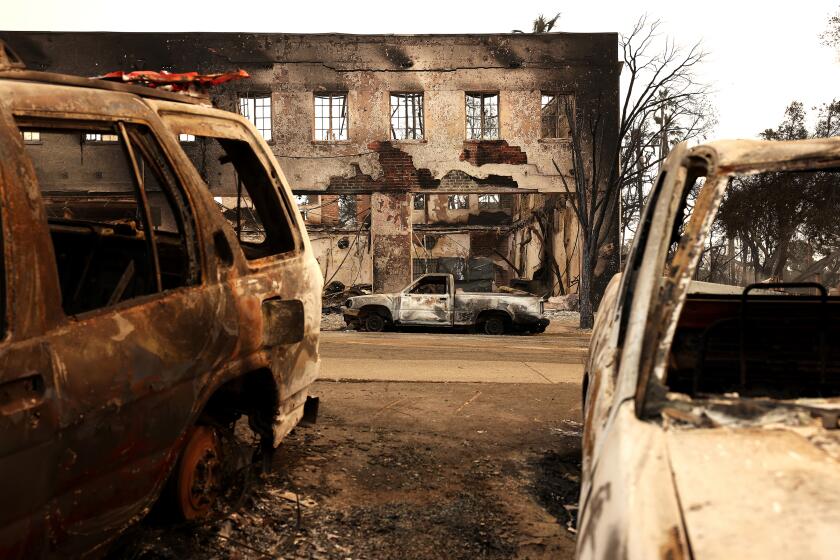
The inferno that won’t die: How the Thomas fire became a monster

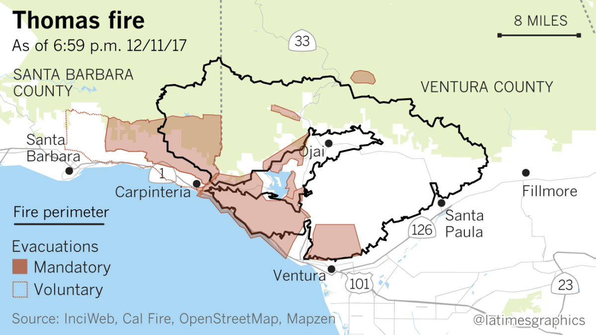
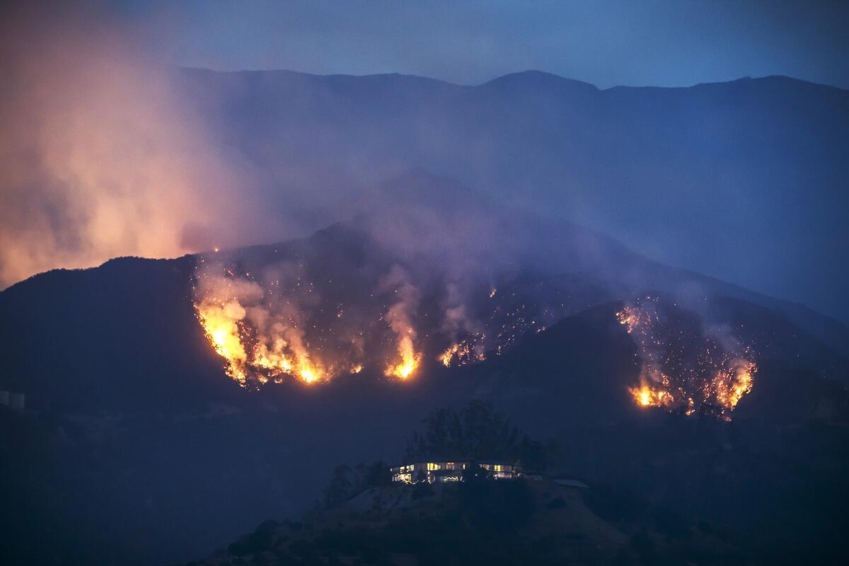
Reinvigorated by Santa Ana gusts and canyons of bone-dry vegetation, the Thomas fire surged into the Santa Barbara County foothills Sunday, forcing evacuations in the coastal communities of Carpinteria and Montecito.
On Friday, an army of firefighters in Ventura County hoped it was finally beginning to turn the tide on the Thomas fire.
After burning hundreds of homes, the fire was slowing as Santa Ana winds calmed down.
But over the weekend, the fire reemerged with a vengeance, pushing into Santa Barbara County and destroying more homes.
Here’s a look at the fire that has refused to die.
HOW DID IT BECOME A MONSTER?
It was wind, but also a landscape filled with fuel
So how did the Thomas fire become such a monster? Heavy winds are one factor. But another is the thick brush that has not burned in decades, providing fuel.
“The fuels in there are thick and they're dead, so they're very receptive to fire,” said Steve Swindle, spokesman for the Ventura County Fire Department.
The fuel can spread the fire even when winds die down.
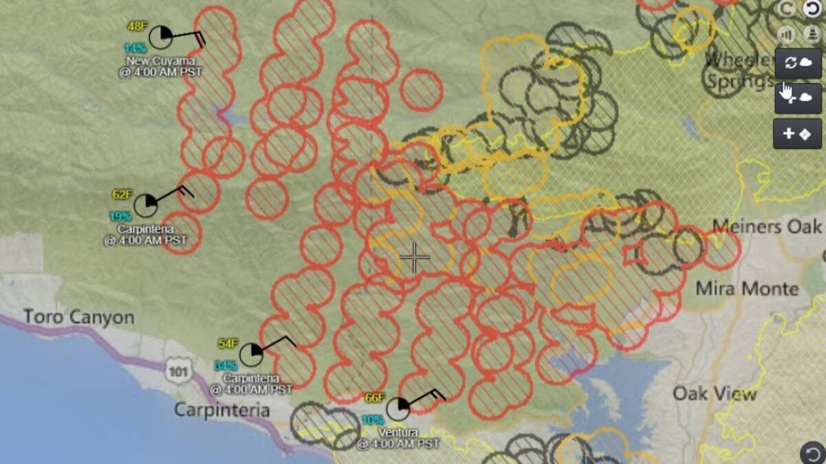
“Since it’s so dry out there, it doesn’t take much in the way of winds to create those critical fire weather conditions,” said Robbie Munroe, a meteorologist with the National Weather Service. “We’ll see wind gusts in that ... area between 20 and 35 mph, maybe a few mountain sites might see up to about 40, but that’s the most we’re expecting right now.”
When the fire shifted toward the coast Sunday morning, Monroe said winds were not necessarily the driver.
“Wind was probably not the biggest factor last night to this morning — it’s probably more the complex terrain, very dry and possibly widespread fuels for the fire and the fact that it’s a pretty large and ongoing fire,” he said. “The light offshore winds are certainly a factor, but not as important as they’ve been, say, earlier in the week when we saw much stronger winds over the fire.”
The last time some of the slopes and canyons burned in the mountains east of Santa Barbara was in the 1970s, when four firefighters operating bulldozers died in a rollover accident.
In such difficult terrain, officials with the California Department of Forestry and Fire Protection said on Monday that they have essentially no way to get boots and hoses on the ground to attack the western front of the Thomas fire directly.
Instead, fire crews caravanned out of the Ventura County Fairgrounds on Monday and headed to the residential streets in the south-facing foothills of Carpinteria in Santa Barbara County. That’s where they set up defensive positions and waited just in case the fire moved downhill.
"The terrain ... makes it super difficult for us to position with normal tactics," said Kalin Ramirez, a fire information officer.
During a news conference at the Ventura County Fairgrounds on Saturday, Gov. Jerry Brown said climate change may exacerbate the weather conditions that caused the wildfires to explode. He expressed sympathy for residents who had lost their homes and animals, saying the fires were horrific and a “terrible tragedy for so many people.”
“This could be something that happens every year or every few years,” he said. “We’re about to have a firefighting Christmas.”
A HISTORIC DISASTER
Among California’s 5 worst modern fires
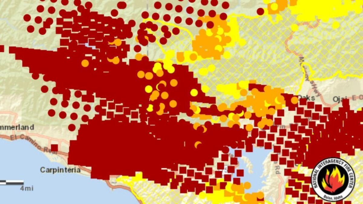
In the last week, the fire has moved in various directions, west into Ventura, then north into Ojai, then west again toward the coast of southern Santa Barbara County.
“This is a complex fire,” Rich Macklin, a spokesman for the Ventura County Fire Department, said over the weekend. “There are hundreds and hundreds and hundreds of men and women with packs on their backs, squirting the hills, putting the wet stuff on the red stuff.”
On Sunday morning, as the blaze spread westward into the mountains, it grew to at least 230,000 acres, putting it in the top five of California’s largest modern fires and creating new challenges for the exhausted crews in their sixth full day of battling it.
With the northern and eastern fronts of the fire moving mainly into uninhabited areas of Los Padres National Forest, fire officials concentrated Sunday on protecting the beach communities of Carpinteria and Montecito, the wealthy enclave to its west.
Throughout the day, the fire moved down the mountains north of Carpinteria into foothills several miles from its downtown. The flames chewed rapidly through hillsides thick with vegetation.
So where does the fire stand now in history?
- The Cedar fire burned 273,246 acres in San Diego County in 2003. More than 2,800 structures were destroyed and 15 people died.
- The Rush fire, caused by lightning, burned 271,911 acres in California and another 43,666 acres in Nevada in 2012.
- The Rim fire in Tuolumne County in 2013 burned 257,314 acres and consumed 112 structures.
- The Zaca fire in Santa Barbara County in 2007 charred 240,207 acres and destroyed one structure.
- The Thomas fire surpassed the Matilija fire — which scorched 220,000 acres in Ventura County in 1932 — as the fifth largest wildfire.
While other large fires raged in California prior to 1932, those records are less reliable, according to the California Department of Forestry and Fire Protection.
The list also does not take into account this year’s wine country firestorm, the most destructive in history, because it was several different fires. Together, that complex of fires destroyed more than 10,000 structures and killed more than 40 people in October.
THE TOLL
Trail of destruction
The Thomas fire has destroyed 524 structures and damaged 135 in the city of Ventura. In the unincorporated areas of Ventura County, 266 structures have been destroyed, while 56 were damaged. The fire consumed six structures on Sunday in Carpinteria, authorities said.
Wind speeds are expected to be on the lower end of what’s been seen over the last week, forecasters say.
Over Sunday night and into Monday morning, there were wind gusts of around 20 mph across the lower mountains and foothills in the region of southeastern Santa Barbara County into southwestern Ventura County.
Officials said it could take weeks or months to finally contain the fire.
ALSO
Battle against Thomas fire enters second week
Live updates: Track key details of all the major fires in Southern California
Thomas fire leaves behind barren 'moonscape' as it threatens Montecito, Carpinteria
Here are maps showing all the major fires in Southern California
UPDATES:
12:30 p.m.: This article was updated with fire maps for Dec. 10
Sign up for Essential California
The most important California stories and recommendations in your inbox every morning.
You may occasionally receive promotional content from the Los Angeles Times.


