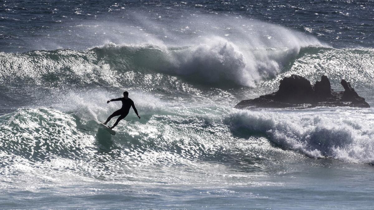
Surfers tackle massive waves along the coast as Southern California prepares for rainy weather this week

- Share via
It’s time to trade in sandals for rain boots as Southern California welcomes its first storm of the season this week.
Some parts of the parched region are expecting up to an inch of rain as two storm systems converge over the area.
Remnants from the now-downgraded Tropical Cyclone Rosa, crawling from northern Baja California toward Arizona, are expected to bring heavy rain and thunderstorms to inland areas in San Diego and Riverside counties beginning Tuesday.
Later in the day, a low-pressure system moving through Southern California will bring precipitation from the coast to the mountains that is expected to last until early Thursday, said Samantha Connolly, a meteorologist with the National Weather Service in San Diego.
Up to a half-inch of rain could fall in areas of Los Angeles, Ventura, Santa Barbara, Riverside, Orange and San Luis Obispo counties, forecasters said. The lower desert area, including Palm Springs, could see up to an inch of rainfall, according to the National Weather Service.

Orange and San Diego counties also could see a chance of thunderstorms.
The National Weather Service issued a flash-flood watch for southeastern California and Nevada as well as northwest Arizona starting Monday afternoon and continuing through Tuesday night.
On Monday, surfers were doing their best to hang onto summer by catching some sizable waves courtesy of Rosa.
The southerly swell rolled in at too steep an angle to provide significant wave heights at most Los Angeles County beaches, but popular spots in Orange County provided a wild ride for surfers.
Waves ranged from 6 to 10 feet at some popular surf spots in Newport Beach. Sets in some areas reached up to 15 feet.
Spectators flocked to the sand early Monday to watch as surfers and body boarders braved the Wedge in Newport Beach, where powerhouse waves have been known to tower more than 20 feet.
About 2½ miles away at the Point near 18th Street, waves were 6 to 8 feet with some 10-foot sets, lifeguard Battalion Chief Mike Halphide said. That was less than the forecast 15 feet Halphide had prepared for with extra staffing, though he said he wasn’t disappointed.
“It’s just not as big as they thought it’d be,” he said.
The waves were clean and the crowd seemed prepared — lifeguards had made only three rescues as of late Monday morning, Halphide said.
Aside from inevitable traffic jams that often accompany rain in California, the upcoming wet weather could provide some relief for the state, which has grappled with a persistent drought in recent years.

The Department of Water Resources said the Oct.1-Sept. 30 water year that ended Sunday was marked by hot and dry conditions, except for sporadic significant precipitation.
During the period, the statewide snowpack was just 58% of average by April 1, a dramatic reversal from the previous water year in which the pack reached 159% of average.
With the rain comes a possibility of mudslides in areas recently ravaged by wildfires, the weather service’s Connolly said.
“We are concerned about debris flow in the burn-scar areas, especially the Cranston burn scar in the mountains and the area around the Holy fire,” she said.
The Cranston fire burned more than 13,000 acres in Idyllwild in July and August, while the Holy fire chewed through more than 23,000 acres of brush in the Cleveland National Forest in Orange and Riverside counties in August and September.
Early Monday afternoon, the Riverside County Emergency Management Department issued a voluntary evacuation warning for those living in the Cranston fire burn areas of Hurkey Creek, Lake Hemet, Apple Canyon and Fleming Ranch.
Orange County officials warned residents in Trabuco Canyon to prepare for the possibility of mud and debris flows along with the rainfall. Riverside County sent out a similar notification about the potential for fast-moving landslides, which can be several feet deep and life-threatening, for residents near the Cranston fire burn area.
Officials suggest residents use sandbags to protect their homes and prepare to leave if rain becomes severe or authorities announce evacuations.
The National Weather Service doesn’t expect the rain to bring the intensity necessary to produce debris flows in the Montecito area of Santa Barbara County, which is welcome news for residents who suffered through deadly mudslides in the area in January. Those mudslides followed the Thomas fire, which burned more than 281,000 acres in Santa Barbara and Ventura counties in late 2017.
But conditions can change with very little notice, so residents in all recent fire areas should remain vigilant, said Bonnie Bartling, a weather specialist with the National Weather Service in Oxnard.
“People should be proactive,” she said. “It looks fine now, but tomorrow or Wednesday, we could have a different situation.”
Times Community News staff writer Hillary Davis and the Associated Press contributed to this report.
Twitter: @Hannahnfry
UPDATES:
6:40 p.m.: This article was updated with additional details
2 p.m.: This article was updated with a voluntary evacuation notice in Riverside County.
This article was originally published at 12:45 p.m.
More to Read
Sign up for Essential California
The most important California stories and recommendations in your inbox every morning.
You may occasionally receive promotional content from the Los Angeles Times.


