First & Spring: L.A. maps out sweeping transportation overhaul
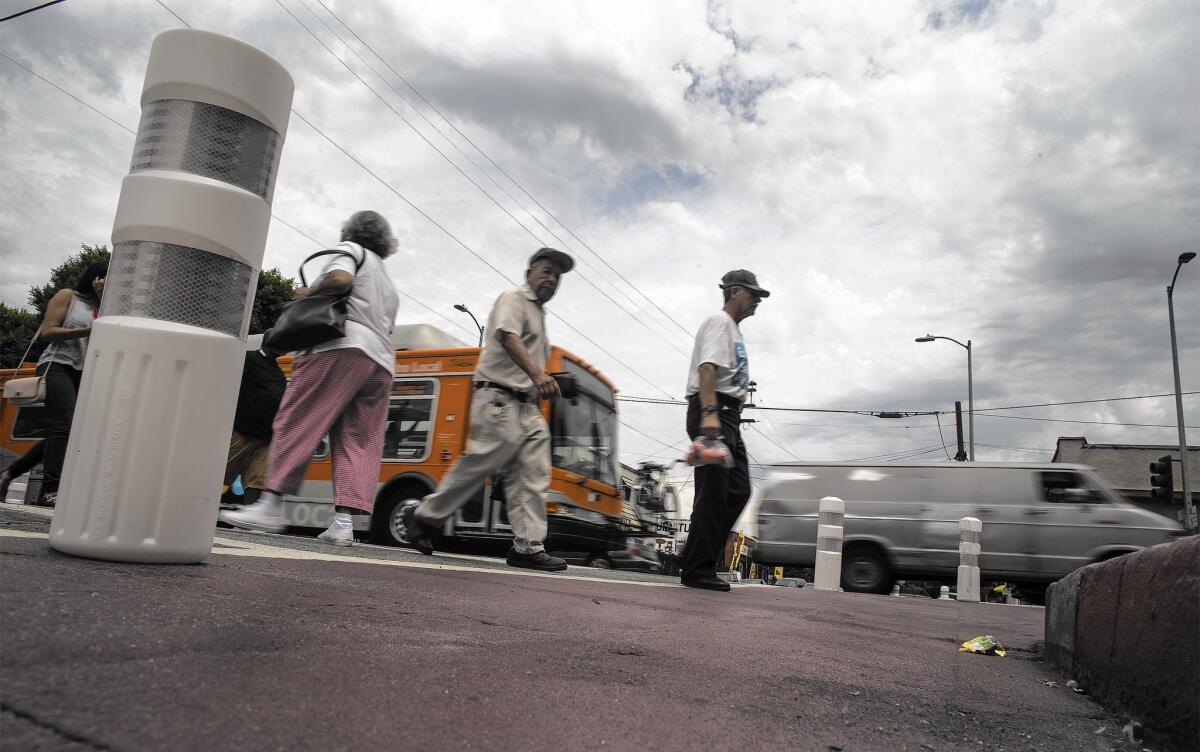
Traffic calming measures such as this red-painted crosswalk are part of L.A.’s Mobility Plan 2035, which backers say puts a new priority on road safety and expands the options for people who don’t want to drive.
First it was a ban on plastic bags. Then came the workplace prohibition on e-cigarettes.
Now the Los Angeles City Council is embarking on a new and controversial exercise in behavior modification: Getting more Angelenos to give up, or at least reduce their reliance on, the automobile.
Council members are on the verge of approving a sweeping new transportation policy, one that calls for hundreds of miles of new bus-only lanes, bicycle lanes and “traffic calming” measures over the next 20 years. The initiative, dubbed Mobility Plan 2035, has sparked a debate over the ramifications of redesigning major corridors such as Van Nuys Boulevard, Sherman Way and Martin Luther King Jr. Boulevard.
NEWSLETTER: Get essential California headlines delivered daily >>
Backers of the mobility plan call it an “aspirational” document, one that puts a new priority on road safety and expands the options for people who don’t want to drive. Opponents say the city’s own environmental analysis shows the plan will significantly increase traffic congestion by subtracting car lanes from an array of major boulevards.
“Cars are just going to sit there,” said Don Parker, a board member with Fix the City, an advocacy group fighting the plan. “So labeling it a mobility plan is just not reflective of what the plan actually does.”
The plan represents the city’s most significant update of its transportation policy since 1999, a time when the city had considerably fewer rail and rapid bus lines.
The document, which goes to the council for a vote later this month, calls for an additional 300 miles of protected bike lanes, which are separated from traffic by curbs or other physical barriers. It also identifies 117 miles of new bus-only lanes and another 120 miles of streets where bus-only lanes would operate during rush hour.
Some corridors — including Sunset, Venice and Lankershim boulevards — would get both bus-only lanes and protected bike lanes under the plan.
Canoga Park resident Brent Butterworth, who frequently uses a bike to get to his appointments, welcomes those types of improvements. Newly installed bike lanes in Northridge have made Reseda Boulevard a much more appealing place to visit, he said.
If the mobility plan’s projects are completed, “you’ll have a little bit more congestion,” the freelance writer said. “But people will look for alternative means of getting around.”
In recent weeks, critics have zeroed in on the city’s environmental impact report, which concluded the mobility plan’s projects would increase not just congestion but also noise and cut-through traffic in residential neighborhoods.
The city’s report also warned of “inadequate” access for emergency vehicles. And it found that during the evening rush hour, the number of major streets operating at an E or F level — the lowest so-called Level of Service ranking available — would double.
Level of Service, a long-used and often-criticized measure of traffic congestion, examines the number of vehicles that move through an intersection during a particular period.
Using that standard, officials concluded that the percentage of major street segments with E and F grades during the evening rush hour would grow from 18% to about 22% in 2035, without the proposed mobility plan. With the plan, the percentage of streets with the lowest grades would climb to nearly 36%, the analysis says.
That figure raises “very serious first-responder questions,” said Richard Katz, a planning commissioner who spent eight years on the Metropolitan Transportation Authority board. If the number of congested intersections grows significantly, firefighters and ambulances will have a more difficult time reaching their destinations, he said.
“Taking away lanes, which creates congestion, to try and force people to choose a different method of transportation other than the car, is a horrible way to solve a congestion problem,” he said. “Why? It creates more congestion … and people don’t respond well to being forced to do things.”
Planning officials say they relied on “conservative, vehicle-centric” projections in evaluating the mobility plan’s potential effects. Put another way, they assumed that the percentage of drivers who choose to give up their cars and start bicycling, walking and taking public transit will remain in line with current traffic patterns.
Westside Councilman Mike Bonin, a key backer of the plan, says he does not believe the worst-case scenarios used by the city will come true. Instead, he pointed to figures that indicate the mobility plan’s projects will increase walking by 38%, transit use by 56% and bicycling by 170%.
“We’ve seen plenty of evidence that behavior is changing and will continue to change,” Bonin added. “You have generations of people under the age of 35 … who are choosing to live car free and car-lite.”
Not every bus and bike project listed in the mobility plan will be built, said Senior City Planner Claire Bowin. And those that are considered will be subject to additional scrutiny, including more environmental reviews and input from public safety officials to make sure emergency vehicles have the proper access, she said.
L.A. officials say the mobility plan is an acknowledgment the city can’t build its way out of congestion problems. Widening streets is no longer feasible or even desirable, they say. And new freeways are out of the question because of the cost and space involved.
“A paradigm shift of this kind often causes growing pains,” said Connie Llanos, spokeswoman for Mayor Eric Garcetti, who supports the mobility plan. “But the long-term benefits outweigh the impacts.”
City officials say an alternative method of evaluating traffic projections, Vehicle Miles Traveled, resulted in a more favorable analysis of the mobility plan. That approach estimates total vehicle miles traveled in a city or neighborhood during a specified period.
Under that analysis, completion of the mobility plan would result in about 35 million miles per day being traveled on L.A. surface streets in 2035. Without the plan, that number would grow to more than 38 million, the city found.
State officials are in the process of eliminating Level of Service as a tool for measuring traffic in the state’s environmental review process, said Juan Matute, associate director of UCLA’s Institute of Transportation Studies. The Vehicle Miles Traveled system is a more accurate way of assessing the environmental impacts of major construction projects, he said.
Regardless of the tool used to assess the city’s plan, Matute expects some drivers will face added delays as the city shifts its emphasis to alternative modes of travel.
“There are going to be people who are going to be worse off as a result of implementation” of the plan, he said. “And those are going to be the people that continue driving the same or greater distances as they do now.”
ALSO:
Forget landmarks: Frank Gehry’s L.A. River plan aims to reclaim water
Grand jury report critical of Kings County’s suits against bullet train draws fire
100 days, 100 nights: How LAPD is dealing with rumors, gangs and fear
More to Read
Sign up for Essential California
The most important California stories and recommendations in your inbox every morning.
You may occasionally receive promotional content from the Los Angeles Times.
