‘The fault will have its revenge’: Bay Area quake reminder of East Bay fault dangers
- Share via
The earthquake that rattled the Bay Area on Thursday is another reminder of the power and danger of the Hayward Fault, which runs below the populous East Bay.
The Hayward fault, along with the San Andreas fault on the San Francisco peninsula, have long posed a twin seismic peril to the region. The San Andreas produced the devastating 1989 Loma Prieta quake and 1906 San Francisco quake.
The Hayward fault could produce a magnitude 7 or greater earthquake and is directly underneath heavily populated areas.

THE FAULT
A sleeping giant
The Hayward fault courses underneath Berkeley, Oakland, Hayward and Fremont and produces a large earthquake, on average, every 160 years, with a margin of error of about 80 years. It has been 150 years since the Hayward fault last ruptured, unleashing a huge earthquake.
The Hayward fault is considered one of the nation’s most dangerous faults because it is directly under the urban centers of the East Bay, including Memorial Stadium at UC Berkeley and a now-shuttered building that formerly housed Hayward City Hall, which is slowly being torn up by fault movement.
A U.S. Geological Survey scenario for a 7.0 earthquake on the Hayward fault envisions it rupturing for 52 miles from San Pablo Bay to Fremont. It would cause one side of the fault to move four feet from the other. Many buildings, including apartments, still sit directly on top of the fault line, and were built before a state law passed in 1972 prohibiting new construction or substantial renovation on top of earthquake faults.
On its website, the USGS calls the Hayward fault the region’s “tectonic time bomb,” which could “cause hundreds of deaths, leave thousands homeless and devastate the region’s economy.”
In 2016, David Schwartz, a USGS geologist, said in an interview that above the Hayward fault are “2 million people who directly live on top of it. It sits geographically in the center of the Bay Area. There’s a tremendous amount of infrastructure built up on it — water systems, gas, electrical, BART crosses it — so a large event on that fault is like hitting the bull’s eye on a target.”
Here is a simulation of the power of a 7.0 quake on the fault. And a shake map.

HISTORY
A rupture in 1868
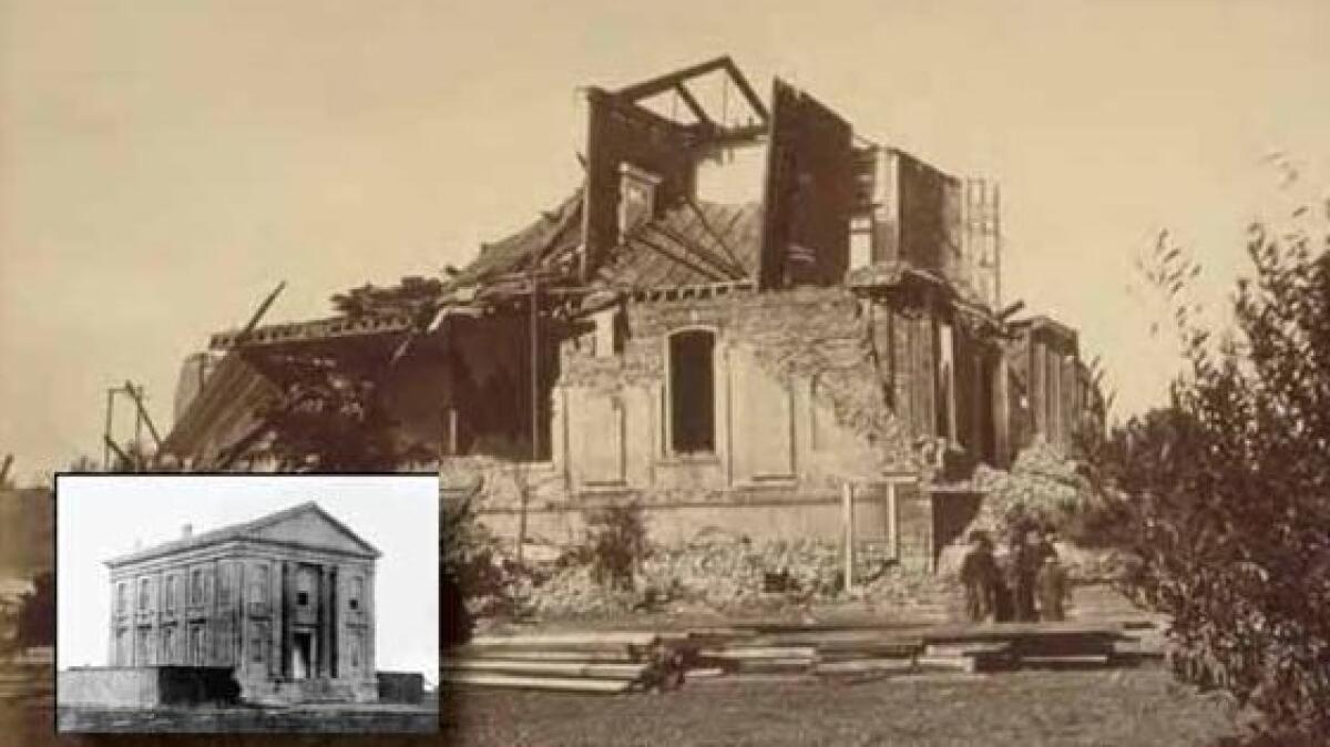
The Hayward fault’s most memorable earthquake in recorded history was in 1868, and is estimated to have been a magnitude 6.8 earthquake — rupturing 20 miles of the fault’s length between San Leandro to what is now the Warm Springs neighborhood of Fremont, according to the USGS.
It killed about 30 people and caused immense property damage, including the collapse of the Alameda County Courthouse’s second floor and heavy damage at the historic Mission San Jose adobe church in southern Fremont.
MARKERS
‘The fault will have its revenge’
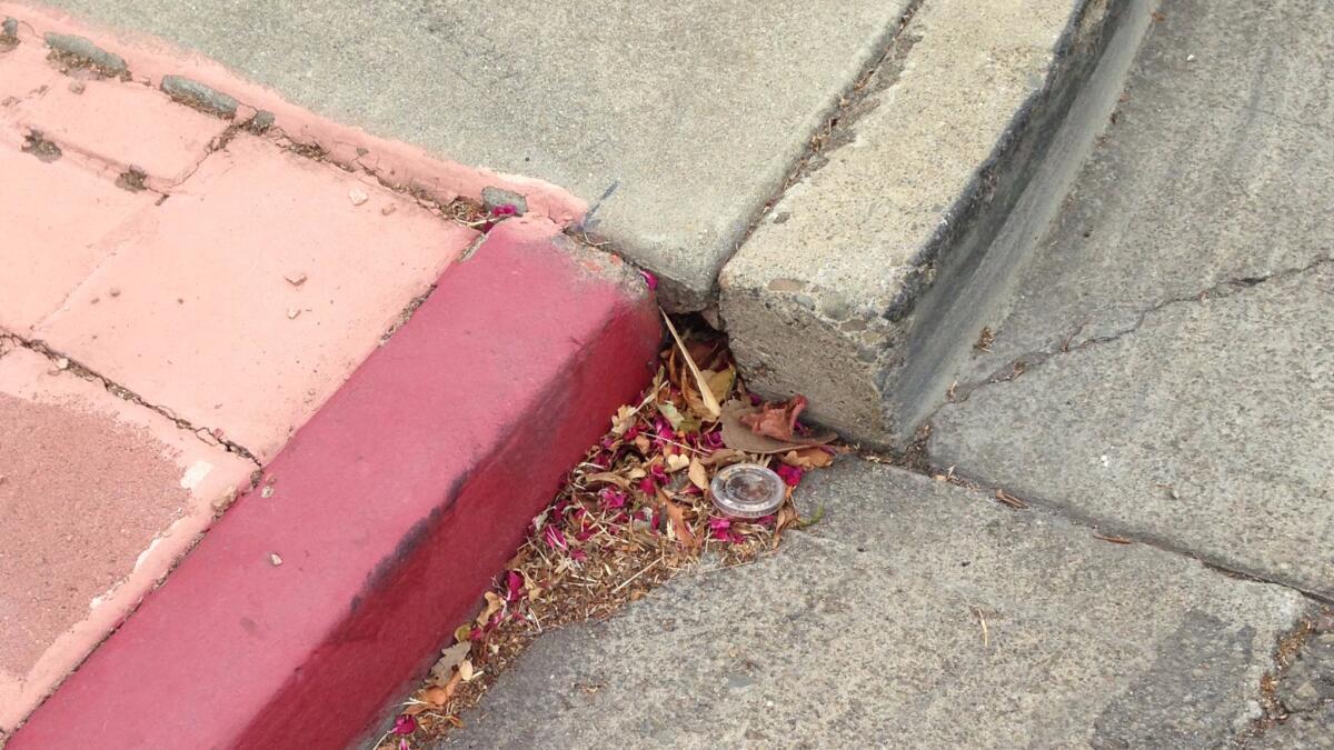
Until recently, one of the places to see the power of the Hayward fault was at the corner of Rose and Prospect streets in Hayward.
Pulled apart so that it no longer aligned, the humble curb wasn’t much to look at. But for earthquake scientists, it was a kind of Holy Grail, perfectly illustrating the seismic forces at work underneath this Bay Area neighborhood.
Since at least the 1970s, scientists have painstakingly photographed the curb as the Hayward fault pushed it farther and farther out of alignment. It was a sharp reminder that someday, a magnitude 7 earthquake would strike directly beneath one of the most heavily populated areas in Northern California.
Then, in 2016, a city crew decided to fix the faulty curb, destroying the marker of seismic power.
“They really took it out. Wow,” Schwartz told The Times. “It really was an iconic location on the Hayward fault.”
But he added a warning: “The fault will have its revenge.”
Sign up for Essential California
The most important California stories and recommendations in your inbox every morning.
You may occasionally receive promotional content from the Los Angeles Times.


