With 5 inches of rain expected in Santa Cruz mountain burn areas, officials fear mudslides

BOULDER CREEK, Calif. — As drizzle began falling here Tuesday afternoon residents scurried to stockpile survival essentials. Some were prepared to hunker in place for a week, or two — assuming that roads would be closed and power would be lost amid massive mudslides. Others shouldered “go bags” and filled their cars and trucks with pet food, personal documents and keepsakes before evacuating their homes for an indeterminate period of time.
The day before, officials had ordered evacuations throughout the Santa Cruz Mountains, saying an anticipated rain and wind event could trigger massive debris flows, road closures and prolonged power outages in areas scorched by the CZU August Lightning Complex fires this past summer.
Matt Machado, the director of Santa Cruz County’s public utilities, called the coming rains a “one-off” event — suggesting the damage incurred from the relatively mild atmospheric river event could be historic. Evacuation areas included Boulder Creek, Ben Lomond, Davenport and parts of San Mateo County.
The storm was bad news for Boulder Creek and other communities located in steep and narrow canyons visited recently by fire. A rain band that sits over a severe burn scar for just 15 to 30 minutes could send mud, boulders and vegetation roaring through roads, homes, and business districts along the San Lorenzo Valley and coast.
Along Boulder Creek’s main drag Tuesday, residents streamed into Scarborough Lumber to purchase kerosene, lamp oil, gasoline jerrycans, lamps, flashlights and wood burning pellets.
As dark clouds rolled in, cashier Sibylle Weikel said she’d been working nonstop since the morning.
“People have been coming in all day,” she said. “There’s been a constant line.”
The hardware store, like its next-door neighbor, Redwood Keg Liquor & Deli, sits within the evacuation zone.
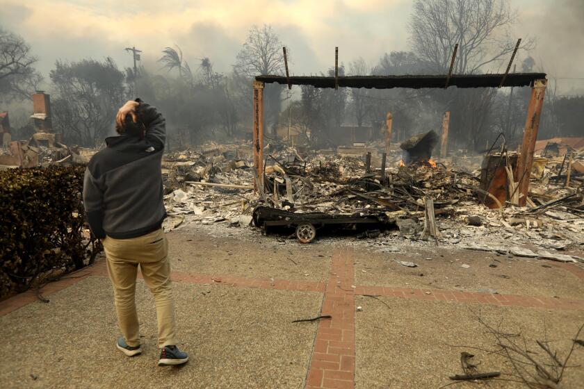
This past summer, fires burned throughout the hills and ridges above town — scarring the steep hillsides that jut into the valley and burning hundreds of homes.
California has a long history of lightning-caused fires, but 2020 is showing how a changing climate can affect the growth of such blazes.
Jane Presswood, the owner of the liquor store, said she was closing down early Tuesday and expected to remain closed until Friday.
She and her husband were heading to a hotel in Santa Cruz to ride out the storm, she said. Some of her neighbors however are staying put, including John Moxon, who was chatting with Pressman at the store while buying himself a lottery ticket.
“Hope I don’t become a statistic,” he said, with a rueful laugh. Then he suggested he might end up leaving, if things started looking bad.
The area is expected to receive 5 to 7 inches of rain over the next three days, with isolated areas seeing more. Those levels will exceed thresholds required to trigger debris flows in the area. According to geologists, the thresholds are 0.3 inches of rain within 15 minutes, 0.5 inches within 30 minutes, or 0.7 inches within an hour.
“These thresholds, we’re going to meet them,” said Chief Deputy Sheriff Chris Clark, of Santa Cruz County. “And not only are we going to meet them, there’s a whole other component of this storm that, frankly, really concerns me ... and that’s the wind.”
Forecasters are predicting 30-50 mph wind gusts along the ridges and summits as the storm approaches, potentially downing power lines and trees. That could make evacuations and rescue attempts not only difficult, but potentially impossible.
Kelly Foster, who owns a house off of Swanton Road, near the coast, said he was feeling reasonably prepared “unless the hillside above lets loose, in which case none of my prep work will matter.”
Officials from the county and the California Department of Forestry and Fire Protection, including CZU Unit Chief Ian Larkin, urged people to leave before the rains began.
“We just ask you to heed these warnings and get out of the way because you will not hear a debris flow when it occurs. When you hear it, it’s too late,” he said Monday.
East of Boulder Creek, crews from Santa Clara County were parked along the shoulder of Bear Creek Road, waiting to clear the winding, two-lane thoroughfare of collapsed trees and limbs — clearing paths for emergency crews and later, evacuating residents.
Debris and tree branches from a wind event that struck the area last week still littered the shoulders of Highways 35 and 9.
The event disrupted power to hundreds in the area, said Eric Scoredos, who was at the hardware store searching for lamp oil Tuesday.
Scoredos said he’d just gotten his power back a day ago, and he expected to lose it again that evening or the next day.
“Seems we go from one event to the other,” he said. “That’s just life in Boulder Creek.”
More to Read
Sign up for Essential California
The most important California stories and recommendations in your inbox every morning.
You may occasionally receive promotional content from the Los Angeles Times.


