Diablo winds can feed Northern California fires. Here’s how they form
Diablo winds in Northern California are similar to the Santa Ana winds that occur in Southern California.
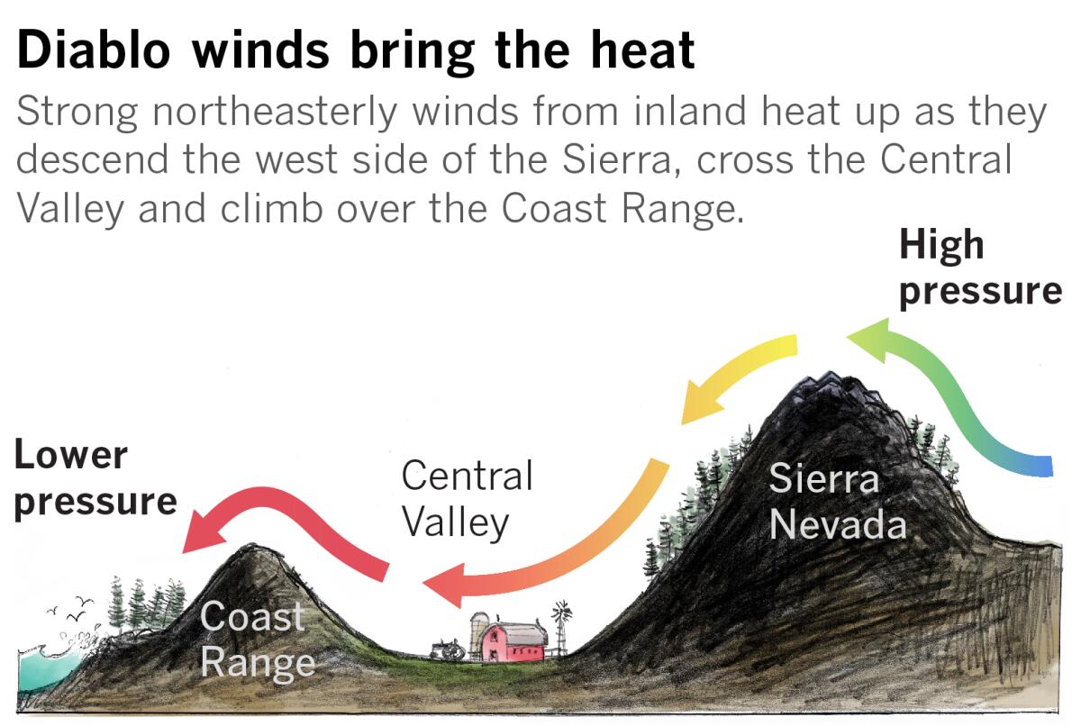
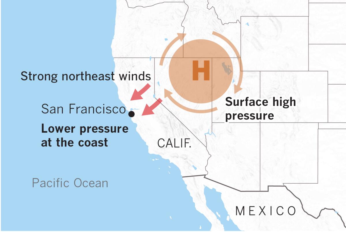
Like Santa Ana winds, they originate hundreds of miles inland in the desert regions of the Great Basin. There, circulation around a strong area of surface high pressure flows over the Sierra Nevada, heading toward lower pressure at sea level.
The air rushing over the peaks and down the western mountain slopes heats up from compression, dries out and speeds up as it is forced through narrow canyons and passes.
As it crosses the Central Valley, the air dries out more, then it lifts up and over the Coast Range. That gives it a second round of compression heating as it funnels down the western coastal slopes toward the Pacific Ocean.
The dry northeasterly offshore flow clears out marine fog and stratus that usually drape the San Francisco Bay Area, and it can create extremely dangerous fire conditions throughout Northern California because of the strong winds and low relative humidity.
The winds’ colloquial name comes from Mt. Diablo, a 3,848-foot peak in Contra Costa County east of San Francisco Bay and east-northeast of San Francisco. Also, the word diablo means “devil” in Spanish, which is appropriate for the hot, dry, destructive winds that blow from the general direction of Mt. Diablo.
The Oakland Hills firestorm of October 1991 resulted from Diablo winds, and Diablo winds occur most frequently in October. That coincides with the season when fuel moisture is at its lowest, leading to the most severe fire danger.
More to Read
Sign up for Essential California
The most important California stories and recommendations in your inbox every morning.
You may occasionally receive promotional content from the Los Angeles Times.

