Wet winter forecast has come up dry
- Share via
The National Oceanic and Atmospheric Administration on Thursday dramatically downgraded its forecast for a winter of warm El Nino rains, the latest twist in a year of weird weather across Southern California.
Federal weather officials had been saying for months that the region would have a wet winter, but the Southland hasn’t recorded significant rain since May.
NOAA said the latest weather and ocean temperature data now show that El Nino will have “minimal effects” across California and the rest of North America, following the lead of other forecasters, who in recent weeks said El Nino was fizzling.
“The problem with forecasting El Nino is that it’s like shooting craps,” said William Patzert, a climatologist for the Jet Propulsion Laboratory in La Canada Flintridge. “The dice are loaded with this global warming thing, but we don’t know exactly how they’re loaded.”
Some forecasters now believe the region is in for a record dry spell.
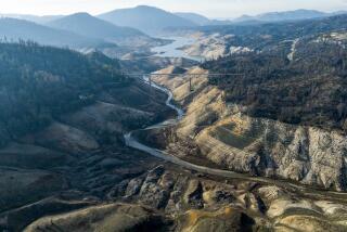
California was hit by a record heat wave that killed more than 100 people in the summer, and is just now emerging from a near-record cold snap that destroyed at least $800 million worth of crops and brought a dusting of snow to unexpected places, such as Westwood.
The one thing the weather extremes have in common is arid conditions -- so much so that the Metropolitan Water District is urging residents in parts of Los Angeles and Ventura counties to temporarily conserve water because usage is double the normal for January, making it difficult to repair equipment.
“It’s been hot and dry, mild and dry and freezing and dry,” said Patzert. “The word that keeps popping up is ‘dry.’ ”
The rainstorm earlier this week dropped only 0.18 inches of rain in downtown L.A.
Since the rainfall season began in July, downtown has seen just 1.50 inches -- 5.62 inches less than normal.
The rain totals are higher in some valley and hillside areas, but still well below normal.
The latest storm “brought our monthly total for January in downtown L.A. to a whopping 0.19 inches,” said Jamie Meier, a meteorologist for the National Weather Service in Oxnard. “And there’s no rain expected in the next seven days. There’s nothing in sight to break the trend.”
Forecasters said there is no easy explanation for the extreme weather. But Patzert said the lack of a strong climate pattern like El Nino in Southern California has allowed a polar jet stream to the north to swing wildly.
The warm Pacific waters of El Nino usually moderate the cold weather from the north. But this year, the polar jet stream has had a much larger influence over local weather, Patzert said.
The results: Jan. 8 marked a warm-weather record of 88 degrees, while less than a week later L.A. recorded a record low of 36 degrees.
“The climate is a lot like teenagers. If you don’t give them structure, you get a lot of bad behavior,” Patzert said.
For perspective, consider the driest year in L.A.’s documented record: In 2001-02, 3.66 inches of rain fell between July 1 and Jan. 31. Then it got really dry. February, Southern California’s wettest month, produced virtually no rain, and March was no better.
Up to now, the 2006-2007 season has been even drier. But forecasters still believe it’s possible the region will see more rain later this month and next. If it continues dry, however, officials said L.A. could be on the road to setting another record.
The dry spell has stretched from the northern Sierra to San Diego.
“We’re definitely on the dry bull’s-eye,” Patzert said. “The bull’s-eye’s on L.A., but it’s a bigger target.”
The weather has caused the fire season to extend into January and left people dealing with dry skin and eyes.
NOAA scientists for months had been predicting a winter of warm El Nino rains -- citing a warming sea surface in the equatorial Pacific.
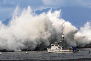
El Nino has been responsible for some of Southern California’s most destructive storms, flooding neighborhoods in 1998 and toppling piers in 1983.
As recently as Jan. 12, NOAA predicted that El Nino would persist through March.
But this year has not adhered to the classic El Nino script. During strong El Nino events, the Pacific Northwest is typically dry, and the polar jet stream weakens and stays to the north.
Instead, the Pacific Northwest has been drenched by record rains. And the storms that have buffeted Southern California have been cold Arctic ones that are rare during El Nino years.
Patzert said the rains are definitely needed in California, while the Pacific Northwest could use a break.
Until now, some weather experts had hoped there would be a rainy, El Nino-induced reversal of fortune for Southern California.
James O’Brien, an emeritus professor of meteorology and oceanography at Florida State University who is nicknamed “Dr. El Nino,” said there were intriguing signs.
The last time citrus crops had frozen in California was in 1998, and that was the year of the most recent huge El Nino, O’Brien said.
But he added that the Arctic outbreaks that caused the deep freeze are actually rare in El Nino years.
Others looked at the relatively mild hurricane season, noting that El Nino conditions tend to be a factor in reducing the incidence of hurricanes.
But on Thursday, federal officials confirmed what a growing number of scientists have been saying: El Nino is a dud.
And at this point, no one is sure what’s coming next.
“Now that El Nino is collapsing, wouldn’t it be ironic if the high-pressure ridge which has steered water-delivering storms to the north now broke down and finally gave us our share?” Patzert said.
“Seattle has definitely been on their knees. They’ve had enough. L.A. needs a dip in the rainfall barrel.”
*
More to Read
Sign up for Essential California
The most important California stories and recommendations in your inbox every morning.
You may occasionally receive promotional content from the Los Angeles Times.


