Vinland Map May Be Authentic After All
- Share via
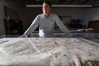
The controversial Vinland map, which includes the northeastern coast of North America and purportedly dates from the mid-1400s, may be a legitimate historical artifact rather than a forgery, according to a Smithsonian researcher. If it is legitimate, the map is the only cartographic representation of the continent that predates Christopher Columbus’ arrival in 1492.
The map, purchased by an antiquities dealer in the early 1950s and subsequently donated to Yale University, accurately shows the coastline around Hudson Bay and the Gulf of St. Lawrence. It has long been used as proof that Scandinavian sailors Bjarni Herjulfsson and Leif Eriksson were the first Europeans to visit the New World.
Two reports last summer offered contradictory evidence about the map’s validity. Researchers at the University of Arizona used radiocarbon dating to conclude that the parchment on which the map was drawn dated from about 1434.
But British researchers studied the ink used on the map and concluded that it might not be authentic. They argued that the alleged forger might have used an old piece of genuine parchment but simulated the ink.
Medieval inks were generally made from an iron gallotannate compound. As this ink ages and erodes from the parchment, it turns the parchment brittle and leaves behind a yellow after-image. The British team concluded that a forger had first drawn the map with a yellow ink, then traced over parts of it with a second, black ink to make it appear aged.
One of their key arguments was that the black ink contained carbon to give it a black appearance. Carbon-based inks, unlike those made from iron gallotannate, do not leave a yellow stain as they age.
But Jacqueline S. Olin of the Smithsonian Institution said medieval scribes often added carbon to their iron gallotannate inks -- which did not blacken until after they had dried on the page -- to help them see what they had written. So she looked at other components of the ink.
In this Monday’s issue of the journal Analytical Chemistry, Olin notes that the ink on the map contains trace quantities of copper, aluminum and zinc, all of which were present in gallotannate inks made by medieval methods from a mineral sulfate called green vitriol. The elements are not found in gallotannate inks made by more modern methods, she writes, and a forger working in the early 20th century would not have known to include them.
She thus concludes that the map may well be genuine.
More to Read
Sign up for Essential California
The most important California stories and recommendations in your inbox every morning.
You may occasionally receive promotional content from the Los Angeles Times.


