Soak Up Some Precious Solitude in Chino Hills’ Water Canyon
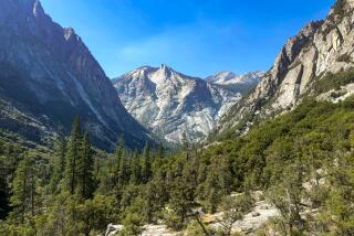
Water Canyon just may be the most compelling place in the Chino Hills. Grand old oak, sycamore, willow and walnut trees shade this quiet enclave, and the steep canyon walls add to the sense of isolation and adventure.
The canyon straddles the border of Orange and San Bernardino counties, but it seems a hundred miles away from the suburban sprawl of either place. It’s particularly attractive because it is accessible only on foot. That’s a rarity in Chino Hills State Park, whose excellent network of dirt roads often is crammed with mountain bikers and horseback riders.
Other times, however, few people are here. On a recent Saturday I counted only five visitors’ vehicles--this in the heart of a state park. Perfect walking weather, not a cloud in the sky, sunny but not hot, air quality as good as it gets. Where was everybody? I counted more rabbits than people.
Directions to the trail head: Chino Hills State Park can be tricky to find. The park is west of California 71, with California 91 to the south and California 60 to the north.
From California 71, exit on Soquel Canyon Parkway and travel one mile to a left turn at Elinvar Road, which bends sharply left. Look immediately right for a signed dirt route called Bane Canyon Road. Enter the park on this road, which becomes pavement again in two miles. Follow signs toward the park office and ranger station.
About a half-mile before the office, turn left into a campground and follow the road to its end at a gate and parking area. Here you will find the start of a connector trail to Aliso Canyon Trail and the loop hike I’m discussing this week.
The hike: The connector for Aliso Canyon Trail heads south across a wide, fairly flat grassland. After about a half-mile, the dirt road dips to cross the creek at the bottom of Aliso Canyon. Just before the crossing, note (but do not follow) an unsigned part of upper Aliso Canyon Trail on your right. This will be your return route.
Instead, look for a junction ahead. To the left, the road leads south to lower Aliso Canyon. You want to go right and walk about 100 yards. At a hairpin turn, ignore the road bending back south toward Skull Ridge; you want to join signed Water Canyon Trail.
This footpath heads west for a mile through the lovely, wooded canyon. After passing a tower of prickly pear cactus and a sign indicating the end of the trail, the path reaches an open area.
To continue your exploration of Water Canyon, follow the canyon bottom west. (No trail is present.) After a quarter-mile or so, you will encounter more stinging nettle and poison oak than you probably care to dodge. A more pleasant option might be to follow the faint but passable path that veers northwest away from Water Canyon. It climbs steeply for about four-tenths of a mile to meet South Ridge Trail, a dirt road. Turn right (east) and enjoy good views of the park’s rolling hills.
A mile-long descent brings you within sight of park headquarters and leads to a junction with the main park road. A sign marks upper Aliso Canyon Trail at this junction. Join this footpath for a three-quarter-mile saunter south with great views of a windmill (a reminder of this land’s ranching history) and handsome alisos (alder trees). The trail meets the dirt-road part of the Aliso Canyon Trail connector that you hiked earlier. Turn left and retrace your steps to your car.
*
For more of John McKinney’s tips, visit www.thetrailmaster.com.
More to Read
Sign up for The Wild
We’ll help you find the best places to hike, bike and run, as well as the perfect silent spots for meditation and yoga.
You may occasionally receive promotional content from the Los Angeles Times.


