Information Flows on Volcano Risk
- Share via
AMHERST, N.Y. — Technology being developed at the State University of New York at Buffalo has the potential to identify not just when and where a volcano might erupt, but for the first time, the path of its destruction.
Researchers say their work could save the lives of thousands of people worldwide who live in the shadows of volcanoes.
“There are people who are studying these volcanoes all the time and making the forecasts of when it’s going to erupt, and then everybody’s happy it erupts,” said geology professor Michael Sheridan, part of a multidisciplinary team of researchers. “Well, it erupts and then comes down and kills the people, so the outcome is not a happy outcome, and we are trying to focus on that.”
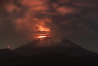
The research involves a blending of mathematical modeling, geologic simulation, scientific computing and virtual reality. Three-dimensional simulations of three active Mexican volcanoes are being created, including the most active one in Colima, about 300 miles west of Mexico City, which has been spouting smoke and ash. Nearby villages have been evacuated.
The detailed simulations of Colima, Popocatepetl, considered the planet’s riskiest volcano, and Pico de Orizaba, North America’s tallest volcano, will show scientists and the general public which way lava, rock and mud could fall during an eruption. The technology, which can be applied to other volcanoes throughout the world, is meant to help public officials determine which areas to evacuate and the best routes to take.
“This is a huge jump forward,” said Sheridan, who has spent the last decade developing small-scale computer simulations of geologic activity in Mexico and has been honored by the Mexican government for his assistance.
Eventually, researchers hope to make the real-time information available to everyone via the Internet, giving people the ability to click on a map to determine whether their road or even building is in harm’s way.
Vulcanologist Shan de Silva said it is a shared goal among volcano researchers to develop an effective warning system.
“That’s an aim a lot of people have, to produce a product that is easily disseminated and readily available to local authorities,” said De Silva, chair of the Space Studies Department at the University of North Dakota at Grand Forks. The department’s Volcano World Internet site tracks volcanoes worldwide.
Scientists pointed to a 1985 eruption of Nevado del Ruiz in Colombia. The debris flow killed 26,000 people. Although a hazard map outlining safety zones existed for the area, the residents were unaware of it.
The project, which has the cooperation of several Mexican institutions and the U.S. Geological Survey, is being conducted under a three-year, $1.9-million grant from the National Science Foundation’s Information Technology Research Program.
The purpose of the grant is to take advantage of technology so that a tragedy similar to the one in Colombia does not happen again, Sheridan said.
De Silva said the technology would be useful to give people a “first order” idea, but he cautioned the data must be interpreted by the holder correctly.
“If you don’t know what the model is telling you, you run the risk of just using it on face value,” he said. “What [models] are very useful for is giving a general idea of volcano hazards.”
Abani Patra, principal investigator on the grant, said the complexity of volcanoes requires that scientists from a broad range of disciplines be involved. The University at Buffalo, with its “supercomputing” capabilities and access to expansive geographical information, is one of few places equipped to conduct such research. It is also the only college currently focusing on mitigating volcano disasters.
Researchers estimate their initial predictions will be accurate about half the time, but they expect the numbers will improve with time and continued work.


