Sprawl Spills Into Remote Canyon
SAN FRANCISQUITO CANYON — Progress in this booming construction zone is heard before it is seen.
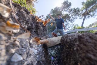
It begins in the predawn darkness with the low growl of engines warming, then erupts into a roar as dozens of giant yellow earth graders, backhoes and bulldozers launch into a synchronized march, gnawing at the straw-colored earth.
Dwarfed by the vastness of the land and finally illuminated by daybreak, the machines snake like Tonka Toys in a conga line, redefining the landscape of San Francisquito Canyon.
The canyon is perhaps best known as the place where the St. Francis Dam collapsed in 1928, becoming the deadliest disaster in Southern California history. Today, it’s the scene of a huge housing boom, as an estimated 7,000 new homes take root in a region once populated by cowboys and Indians and pioneer ranchers.
Sam Cullen, 71, a member of a family that has occupied an 80-acre spread for five generations, cringes when he points to a row of new houses crowded on a ridge overlooking his rustic home.
“This whole canyon is, or was, a haven from the rest of the world. But it ain’t gonna be any more,” he said .
To reach the canyon, motorists once had to travel a tedious route through Soledad Canyon, up Bouquet Canyon to the end of Seco Canyon. The trip, as well as county zoning laws limiting development to minimum five-acre lots, preserved the rural atmosphere.
Now the canyon is only minutes from the Golden State Freeway via Rye Canyon Road, Copper Hill Drive and the extension of McBean Parkway. The new roads, particularly the Copper Hill bridge that spans the wide creek, have opened the region to tract development, with building permits being granted for as many as 27 units per acre.
‘Thousands and Thousands of Homes’
Commuters from outlying regions of the Antelope Valley are rapidly discovering the new route out of the canyon as a shortcut through Angeles National Forest to Valencia business centers and the freeway to the San Fernando Valley and Los Angeles.
“It’s like the Indy 500 is going through here every day, there’s so much traffic,” said Wil Stillens, a fire engineer with the U.S. Forest Service who is stationed in the canyon.
Development now underway brings the urban sprawl from the San Fernando Valley full circle to the first tract homes in the region--Rancho Santa Clarita--built in 1947 in adjoining Seco Canyon.
Cathy Martin of Newhall grew up in San Francisquito through the mid-1970s with a handful of other children.
“We kids owned the canyon. We rode our horses up one side and down the other. We knew every rock and tree,” she said.
Families on the west side of the creek were often marooned by flooding for two to three days at a time during stormy weather, unable to cross the raging creek to the road.
But Martin said she was “just taken away by that whole area” when she returned recently for a visit.
“I couldn’t even find the mouth of the canyon, there was so much development,” she said. “The church on the hill used to be the site of the Corral Drive-In, and the Lewis chicken ranch isn’t even there any more. It is just filled with thousands and thousands of homes.”
Stillens, with the Forest Service, takes weekly trips into the new developments, hand-drawing maps of new roads so firefighters will know how to get to emergency calls.
It’s hard to keep up with the changes. McBean Parkway, for instance, is expected soon to be extended again, from its terminus at Copper Hill a short distance north to San Francisquito, said Randine Ruiz, a county public works planner.
A new road is under construction between hillside developments on the east side of the creek to San Francisquito. Another developer is planning a second bridge across the creek north of Copper Hill, Ruiz said.
“This has been an outpost for a long time, but developers now are knocking on our doors like crazy,” said Syrus L. Keatley, who is retired from the Los Angeles Department of Water and Power and has owned a 40-acre ranch in the canyon for almost 30 years.
Keatley and his neighbors fear that development speeding toward their doorsteps will erase not only their tranquil lifestyle, but the history and lore of the canyon--which includes heroes and villains and movie stars and ghosts.
Dam Collapse Haunts Canyon
Before the turn of the 20th century, Butterfield-Overland stagecoaches and freight wagons rumbled through the canyon, which was the main route between Los Angeles and Bakersfield before the Ridge Route was completed in 1915. Outlaw Tiburcio Vasquez was among the travelers, usually moving at a gallop and stopping only to trade local ranchers a bag of gold for a fresh getaway horse.
Film actor Harry Carey ran an Indian settlement and trading post on what is now--or was--the Farmer John Ranch, once used to raise hogs for hot dogs and now being carved by earth graders for the 1,109-home Tesoro del Valle development.
Graders also are at work for the Newhall Land & Farming Co. on the adjoining West Creek project, approved by county supervisors last month for 2,545 new homes.
The craggy hills and cliffs are the route of the lifeblood of Los Angeles--the aqueduct from the Owens Valley, completed in 1913. Los Angeles’ original electrical supply was generated at its first two hydropower plants in the canyon, built in 1917 and 1920.
And then there’s the St. Francis Dam disaster of 1928.
Relatively few people knew about the dam when it was completed in 1926, seven miles north of the canyon’s mouth. The 19th and final dam project of William Mulholland--the “Father of the Los Angeles Municipal Water System”--the dam held more than 12 billion gallons, a one-year supply for the entire city. Angry Owens Valley farmers were repeatedly vandalizing the aqueduct system and Mulholland wanted a secret cache as a backup.
Just 21 months after it was completed, the dam failed--geologists say it was undermined by an ancient landslide--2 1/2 minutes before midnight on March 12, 1928. A muddy wall of water as high as 140 feet carved a 54-mile path of death and destruction in a 5 1/2-hour journey from San Francisquito Canyon to the sea.
The deluge killed more than 450 people living in the canyon and along the banks of the Santa Clara River, nearly as many as perished in the 1906 San Francisco earthquake.
Giant pieces of the dam are still scattered in the creek.
Some of the flood victims are buried in a private graveyard high on a hill under pepper trees and pines, on a ranch in the canyon. Victims included 10 members of the Ruiz family (no relation to Randine Ruiz). There are also unmarked stones for bodies that were found, but never identified.
The names of other families who occupied the land over the decades are there, too--Cordova, Kirkpatrick and Cooke.
For now, there are no plans to develop the land where the graves are located. But environmentalists, historians and others say there appears to be no stopping the parade of graders.
“We have this incredible sprawl and no water for it,” said Lynne Plambeck of Santa Clarita Organization for Planning the Environment and an elected water district director. “I feel very frustrated.”
Land No Longer Recognizable
Residents who regularly commute through the canyon say they are stunned by the extent of transformation. “Growth has exploded,” said Carlos Holguin, a Los Angeles attorney who lives in remote Green Valley, deep in the canyon. “Developers seem ready to cover every square inch.”
Holguin took note of the massive grading for homes near the junction of San Francisquito and Seco Canyon roads.
“That was a huge mountain,” he said. “And they just leveled the thing.”
More to Read
Sign up for Essential California
The most important California stories and recommendations in your inbox every morning.
You may occasionally receive promotional content from the Los Angeles Times.


