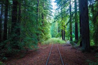
Lonesome Route of the Prospectors
Lonesome Miner Trail is every bit as lonely as its name suggests--an old prospectors’ route through some of the most rugged and remote back country in California.
No doubt most of the miners’ old trails in the Inyo Mountains could be categorized as lonesome, but this particular path was named by the Bureau of Land Management and volunteer trail builders, who worked very hard to discover--and uncover--it. It traverses the Inyo Mountain Wilderness, established in 1994.
The 49-mile trail, strenuous and difficult to follow, extends from Hunter Canyon in the Saline Valley to Reward Canyon in the Owens Valley. It’s a patchwork of historic trails built by miners from 1867 to 1941. Vistas from the trail include the High Sierra and Death Valley National Park.
The stretch through Hunter Canyon, sometimes called the Hunter Canyon Trail, is easier to follow and more accessible, and a good introduction to the east side of the Inyo Mountains.
A good destination for a day hike is what I call Miners Camp, where prospectors hewed a 20-by-80-foot campsite out of a rock ledge, then built three wooden tent platforms. The ledge and platforms make an intriguing picnic site or campsite.
Directions to trail head: From California Highway 190, about 35 miles southeast of Lone Pine, turn north on Saline Valley Road and drive 38 miles to Saline Valley Marsh. Half a mile north of the entrance to this site, turn west and drive a mile to road’s end and the signed trail head for Hunter Canyon Trail.
The hike: From the old mine equipment in Little Hunter Canyon, the path follows the creek bed past some mesquite thickets up the canyon for one-quarter mile. The trail then leaves the canyon, switchbacking up to the ridge on the south side.
The ridge route continues ascending, offering grand views eastward of Saline Valley, the Last Chance Range and the northwestern reaches of Death Valley National Park. Enjoy the excellent view from Miners Camp as well.
From Miners Camp, Lonesome Miner Trail continues climbing more than 3,000 feet, steeply up the ridge, then descends steeply to Bighorn Spring about another three miles or so from the trail head.
(BEGIN TEXT OF INFOBOX / INFOGRAPHIC)
Lonesome Miner Trail
WHERE: Inyo Mountains Wilderness
DISTANCE: From Hunter Canyon to Tent Platform is 6 miles round trip with 2,100-foot elevation gain.
TERRAIN: Rugged west side on Inyo Mountains
HIGHLIGHTS: Historic miners’ route; grand Saline Valley views.
DEGREE OF DIFFICULTY: Moderate to strenuous.
FOR MORE INFORMATION: U.S. Bureau of Land Management, 300 S. Richmond Road, Ridgecrest, CA 93555; tel. (619) 384-5400.
More to Read
Sign up for The Wild
We’ll help you find the best places to hike, bike and run, as well as the perfect silent spots for meditation and yoga.
You may occasionally receive promotional content from the Los Angeles Times.


