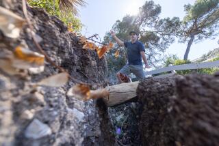
Mapping of Slide Areas Completed : Geology: State survey concentrates on hazardous regions of Santa Paula and Moorpark. Much of the 120 square miles surveyed is unoccupied.
- Share via
After nearly two years of geological surveys, the California Department of Conservation has finished mapping hazardous landslide areas in Santa Paula and Moorpark. Much of the area found to be at risk is unoccupied, although some spots are under consideration for development.
The maps, which provide a detailed geologic survey of a 120-square-mile area, are meant to help city officials plan for future growth and avoid disasters like last winter’s mudslide that swallowed part of La Conchita.
“We’re trying to map out regions before development heads for the hills,” said Allan Barrow, a geologist for the conservation department. “If we can map the area before developers start building, then we can do the most good.”
Moorpark geologic consultant Mike Phipps said the maps would come in handy for several developments on the drawing board for the city’s more mountainous north and south sides.
The majority of Moorpark’s homes are built in the lowlands, where the threat of mudslides is minimal, Phipps said. But city officials are evaluating proposals for several hundred houses higher up in the hills, he added.
The city of Santa Paula has established guidelines for hillside development even though there are few steep slopes within its boundaries and consequently little fear of major landslides, Planner Jeff Hamilton said. Those guidelines require grading, limit the number of units built, and ensure that new housing is safe and doesn’t threaten homes farther down slope, Hamilton said.
“The maps should further highlight areas we need to be careful about developing,” he said.
The most dangerous area mapped by the conservation department--the rugged and deeply eroded South Mountain and Oak Ridge area between Santa Paula and Moorpark--is populated solely by oil wells.
“It’s too unstable to develop, but the area might make good parkland one day,” Barrow said.
Many hills in the mapped-out area can be developed, but safeguarding homes from landslides is costly, Barrow said.
“Just about any area can be developed because landslides are a fixable problem,” he said. “But massive grading and buttressing can be prohibitively expensive. Sometimes it’s easier to leave an area alone than try to build houses on a mobile landscape.”
California landslides cause on average more than $100 million in damage a year and claim about five lives, according to conservation department figures.
Ventura County is particularly prone to dangerous mudslides, as witnessed by residents of the small seaside village of La Conchita.
Contributing to Ventura County’s landslide problem are brush fires and floods that lead to erosion.
The region’s geological makeup also plays an important role.
For millions of years, much of Ventura County was an ocean floor--seashells can still be found miles inland from the county’s beaches. About 500,000 years ago, strong tectonic activity pushed the county up from below sea level to its current topography of mountains, valleys and plains.
But because the land was once underwater, it mainly consists of weak rock formations made up of silt, clay stone and sandstone, which are prone to erosion, Barrow said.
To make matters worse, the area’s earthquakes further loosen hillsides.
“Fortunately, most of the development in the county is on lowlands,” Barrow said. “But people will eventually move into the hills, and the dangers of landslides will increase.”
More to Read
Sign up for Essential California
The most important California stories and recommendations in your inbox every morning.
You may occasionally receive promotional content from the Los Angeles Times.


