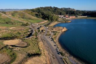
Caltrans-Owned Land May Be Used for Park in Newport
- Share via
NEWPORT BEACH — A group of west Newport Beach residents who have worked for two years to get Caltrans-owned land turned into a park saw the Planning Commission take the first major step toward making its dream a reality.
The commission, in a 5-0 vote last week, approved an agreement that would allow Caltrans to trade the land at West Coast Highway and Superior Avenue for housing credits to be transferred to other land in the city.
The City Council asked planners several months ago to negotiate with the California Department of Transportation for a deal that would allow the city to downzone the property without paying Caltrans for the reduced resale value.
The undeveloped property was zoned for 152 condominiums, but neighbors--who refer to the 14.25-acre Caltrans West parcel as Sunset Ridge--had long lobbied for ball fields and play equipment in park-poor west Newport.
If the plan approved by the Planning Commission passes the City Council as well, Caltrans would be able to build the condominiums elsewhere or sell the building rights to a developer to use on another piece of land.
The plan is scheduled to go before the council in February.
One detail left to be resolved is a small corner of what was once the same parcel but was split when Superior Avenue was rerouted.
Advance planner Patti Temple said the steeply sloped fragment between Superior and Hoag Memorial Hospital Presbyterian and north of a public parking lot was overlooked in the negotiations but will be added before the plan goes to the council.
More to Read
Sign up for Essential California
The most important California stories and recommendations in your inbox every morning.
You may occasionally receive promotional content from the Los Angeles Times.


