Soaking Wet
- Share via
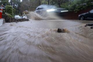
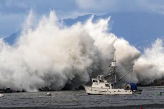
Southern California was handed its latest dose of natural disaster on Tuesday, with record amounts of rain falling across the region. Here is a look at the problems and a glance at what’s ahead.
More Misery in Malibu Much of Southern California was swamped on Tuesday. But for Malibu, the flooding was just the latest in a long line of calamities caused by the elements--the most recent being the raging wildfires of 1993. Here is a look at two spots along Pacific Coast Highway in Malibu that took a beating Tuesday:
Civic Center area
1. PCH: Closed to general traffic about 7:30 a.m.; closed to residents about 12:30 p.m.
2. Malibu Lagoon Bridge: Bridge over Malibu Canyon Creek closed at 12:30 p.m. because of fear of collapse.
3. Pepperdine University: Classes canceled. Campus used for helicopter evacuation of residents from nearby canyons.
4. Shelter: Red Cross emergency shelter set up near Pepperdine in Malibu Bluff Park.
5. Surfrider Beach: Cluttered with tree trunks and debris washed down by Malibu Canyon Creek.
6. Businesses: Stores in Cross Creek Mall closed.
Las Flores Canyon
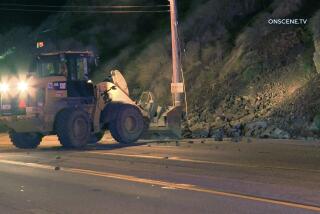
1. PCH: Closed to general traffic about 7:30 a.m. Several mudslides reported; one car trapped.
2. Las Flores Creek: Overflowing; emergency crews use backhoe to remove debris.
3. Nursery: Floor and creekside walls of Cosentino’s Nursery collapse.
4. Evacuation: About 50 people evacuated from homes and businesses near foot of canyon.
5. Businesses: Many closed along PCH, including Charley Brown’s Restaurant.
6. Las Flores Creek Bridge: Support erodes, resulting in temporary closure.
When Rain Saturates The Ground Heavy rains can cause street flooding and minor mudslides, but a longer- term problem occurs when the soil gets oversaturated. Here is a look at what can happen: A. When rainfall is less than 4 to 6 inches, there tend to be few problems. B. When the rainfall approaches 6 to 10 inches, soil begins to saturate and can absorb less water. Small mudslides with a few feet of soil washing away can occur. C. With more than 10 inches, real problems begin. The water undermines bedrock layers of compacted earth, which can lead to massive landslides during the storms or later in the year.
What’s Coming Up Tuesday’s downpour should be the last “major dumping” of rain on Southern California, at least for the next few days, according to WeatherData Inc., a private forecasting firm. Here is a look at how the picture is shaping up through the weekend: 1. The basic storm system currently inundating most of the state will shift slowly northward. This is bad news for the flooded areas to the north, which will continue to get rain off and on through the weekend.
Showers will continue in Southern California through today with a slight chance of rain on Thursday, but it should be drier here as system shifts. 2. The main jet stream is continuing to come through Hawaii instead of the Gulf of Alaska. The warmer flow means snow levels are higher than usual in the local mountains and the Sierra Nevada. 3. Meterologists are watching a week low- pressure area several hundred miles north of Hawaii, which is moving toward the mainland. Sources: WeatherData Inc.; Researched by PAUL FELDMAN, VICKY MCCARGAR / Los Angeles Times
More to Read
Sign up for Essential California
The most important California stories and recommendations in your inbox every morning.
You may occasionally receive promotional content from the Los Angeles Times.


