CALIFORNIA ALBUM : Ridge That Is Armed and Dangerous : Residents in a San Bernardino Mountains canyon do not fear the earthquakes as much as the massive boulders that come tumbling down afterward.
FOREST FALLS — The residents in this rough-and-ready canyon village in the San Bernardino Mountains have steeled themselves against nature’s high jinks over the years--the snow avalanches, the flash floods, the fires.
But when a granite boulder the size of a parcel delivery truck crashed down the mountainside last summer, stopping just 100 feet shy of Kelly Clarke’s place while his wife cowered underneath the dining room table, the townsfolk were left shaken by a new awareness:
The mountain ridge that shades the canyon as early as 1 p.m. is armed and dangerous, ready to hurl chunks of itself on the town below with the next big earthquake.
And given last week’s revised predictions by scientists who agreed that the next major quake may come sooner than thought, no wonder the residents in this hotbed of seismic activity are watching the mountainside above them more warily than ever.
Generally, they are stoic about the prospect of crumbling canyon walls. But the 1,500 canyon residents can no longer deny the potential of their homes being splintered into smithereens by careening boulders--huge slabs of granite that seem locked into the mountainside but can be cracked loose, just like that.
That is what happened June 28, when the back-to-back Landers and Big Bear temblors jarred the area and sent two dozen huge boulders into the canyon, including the one that came to rest behind the Clarkes’ home.
State and San Bernardino County geologists hurried here, assessed the potential of more danger and have distributed maps, showing which neighborhoods in the three-mile-long village alongside rocky Mill Creek are most susceptible to rockfall hazard from the canyon’s walls. More than 150 homes were given Zone 1 distinction as potential bull’s-eyes for boulders.
*
Judy Dods lives two doors from the Clarkes and when asked how she is coping with the sight of the boulder, offers a what-do-you-think? laugh.
“We’re trying to live with it, but our situation is precarious,” said Dods, a classroom aide at the elementary school. “Boulders can be catapulted off that mountainside. See that big dark one, embedded in the side? They say that one might go.”
A report by the state’s Division of Mines and Geology stated matter-of-factly: “Hazard from rockfall, containing very large blocks, threatens most of the southernmost structures in the community of Forest Falls.”
While geologists said large blocks may be loosened only during “sufficiently strong earthquake shaking,” it also stated: “The fact that the San Andreas Fault, the most prominent active fault in California that is capable of producing a great earthquake, goes right through the middle of the Forest Falls community is an important and sobering geologic fact.”
Sobering, too, is the sight of the boulder behind the Clarkes’ home, a graphic example of how the Yucaipa Ridge that towers 1,000 feet over Forest Falls can unleash itself if shaken sufficiently--as it did June 28.
Three hours after the desert town of Landers was hit by a magnitude 7.5 earthquake, a 6.6 aftershock struck more acutely here, with its epicenter at Barton Flats, nine miles northeast of Forest Falls.
Kelly Clarke ran outside his two-bedroom home when the second, closer quake struck--and heard a noise that froze him in his tracks.
“Imagine,” he said, “hearing a fleet of Mack trucks driving down a bunch of trees.”
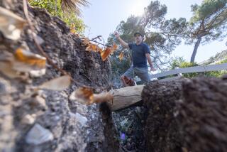
Yelling to no avail for his wife to run outside, he watched in terror as a block of granite 18-by-12-by-10-feet tumbled toward their house--literally bouncing at times and clipping off tops of pines, slicing through trees three feet in diameter and cleanly uprooting other trees in its path.
The boulder that began its fall 700 feet above the canyon floor came to a thundering stop 100 feet from the wood-frame home--and uphill from four other homes.
But the noise did not stop.
*
All around the canyon, situated above Redlands and below Southern California’s highest peak--the 11,499-foot San Gorgonio Mountain--countless smaller landslides were loosened by the shaking earth. Two dozen large boulders--ranging from 50-ton chips to the 250-tonner behind the Clarkes’ home--rolled and bounced down the mountainside. Only one hit a structure--someone’s temporary campsite. No one was injured. Others came precariously close to propane and water tanks.
Within minutes, the canyon found itself enshrouded in a settling dust cloud, so thick that visibility was under 30 feet. Some people thought that there was a forest fire.
The landslides brought with them, some residents said, the strong odor of fresh-cut cedar and pine--the residuals of ripped and broken trees.
Kelly Clarke, wiser for the boulder behind his house, said: “Earthquakes themselves don’t scare me. It’s the sound afterward that scares me. The landslide.”
Geologists say smaller rockslides are commonplace up and down the canyon. But the likes of the Clarke boulder raised eyebrows.
“What’s so surprising is that those large blocks were dislodged from bedrock,” said Allan G. Barrows, a senior geologist for the state and the Forest Falls landslide project manager. “And there are more up there like that.”
Barrows said he did not know of another community as threatened as Forest Falls. Sure, there are other, treacherous mountainsides in Southern California, but they loom over uninhabited areas.
Some folks here embrace a grin-and-bear-it philosophy toward the newly identified risk.
“This is a mountain community, and we’re threatened daily by its fury,” said Tom McIntosh, a real estate agent, captain of the mostly volunteer Fire Department and as much as anyone the mayor and Chamber of Commerce.
“We have to deal with snow avalanches, flash floods, snow floods. A lot of us understood the potential for landslides in the canyon, but up until the June quakes, we thought this was a safe place to be,” he said.
Still, he said, most residents seem ready to shrug off the experience, the state geology report notwithstanding. “Most people are of the attitude: ‘Been there, done that.’ ”
Local Fire Chief Tom Wellman said the community has regained its composure since the June quakes and is trying to take the state geology report in stride. Indeed, when the area was shaken Nov. 27 by a 5.4 aftershock, there were no landslides--suggesting a measure of what the mountains can withstand. True to form, when a 5.2 aftershock occurred Thursday, again the canyon held intact.
“This is a pretty independent community,” he said. “We won’t let this destroy our lives.”
More to Read
Sign up for Essential California
The most important California stories and recommendations in your inbox every morning.
You may occasionally receive promotional content from the Los Angeles Times.


