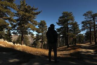
From Robbers Peak, Steal a Look at a Vanishing Land
- Share via
Who determines the names of natural features? Fundamentally, names are a part of language, and the eventual power rests with the people.
--George Stewart, “Names on the Land” Housing developments often take the name of the natural features around them, but in one Orange County suburb, the naming process is reversed.
Geologists and map makers have long referred to the long, low ridge extending west from the Santa Ana Mountains and rising above Santa Ana Canyon as the Peralta Hills, but almost no one uses that name anymore. Today, the hills are called the Anaheim Hills.
The hills honor, or did honor, Juan Pablo Peralta and his family, original owners of the huge Rancho Santiago de Santa Ana. Peralta is a historical and euphonious name. It recalls the Latin expression per alta , “through the high things.”
Anaheim, which German settlers in 1858 named after the river Santa Ana plus the suffix heim (home), already names a city, a boulevard, a bay, a stadium and much more. Perhaps it’s time for concerned hikers and Orange County residents to rally to save the Peralta Hills. (Alas, it is not merely the name of the hills, but the hills themselves that are fast disappearing beneath the suburban sprawl.)
Other names from the past remain. Santiago Oaks Regional Park, Santiago Creek and Santiago Canyon are derived from the old Rancho Santiago de Santa Ana. One intriguing name for a rocky knob overlooking the regional park is Robbers Peak. From this lookout, such infamous 19th-Century outlaws as Joaquin Murietta and Three Finger Jack kept watch over rural Orange County. The outlaws would ride down from the hills to rob the Butterfield stagecoach or ride into the hills to escape the sheriff’s posse.
Santiago Oaks Regional Park preserves 125 acres of pastoral Orange County, including an oak woodland that attracts many species of birds. A checklist of commonly sighted birds is available at park headquarters.
You can sample the park’s ecosystem with Windes Nature Trail. The three-quarter-mile trail and its Pacifica Loop offer a glimpse of the county’s coastline. A nature center, located near the trailhead, is well worth a visit.
A network of fire roads and equestrian trails crisscross the park and extend into the Anaheim Hills. While the hills seem destined for suburban development, for now, at least, you can enjoy a ramble up to Robbers Peak and steal a last look at vanishing rural Orange County.
Directions to trailhead: From California 55 (Newport Freeway) in Orange, exit on Katella Avenue. Turn east on Katella, which becomes Villa Park Road, then Santiago Canyon Road. A bit more than 2 miles from the freeway, turn left on Windes Drive and drive a mile to Santiago Oaks Regional Park. An “Iron Ranger,” a self-service entrance gate, collects the $1.50 per vehicle entry fee. For more park information: (714) 538-4400.
The hike: From the end of the parking area, you’ll spot Windes Nature Trail on your right, then swing left and cross Santiago Creek on some man-made stepping stones. You’ll pass a number of trails leading left into the woods, but for now stay with the main trail along the creek. Along with the native oaks, you might spot some uncommon flora, including eucalyptus and pepper trees, and even a small grove of Valencia oranges.
Soon you’ll see an old dam. With the aid of Chinese laborers, the Serrano and Carpenter Water Co. built a clay dam here in 1879. The dam was destroyed by floods and replaced in 1892 with a more substantial structure of river rock and cement. The dam looks particularly tiny when compared to the huge Villa Park Flood Control dam a short distance upstream.
Bear left, uphill, and ascend steeply up a dirt road to the park’s north boundary gate. Beyond the gate you’ll ascend to an unsigned junction and bear left, then ascend a slope dotted with prickly pear cactus to a junction signed with an equestrian symbol and turn right. After passing under some transmission lines, the equestrian trail reaches Robbers Peak.
From the 1,152-foot peak, you can look over the Peralta Hills and trace the path of Santiago Creek. Not so long ago, the view would have taken in hundreds of cattle, orange groves and barley fields. Nowadays, the panorama is considerably less pastoral.
Anaheim Hills Trail
Santiago Oaks Regional
Park to Robbers Peak
3 1/2 miles round trip;
700-foot elevation gain
More to Read
Sign up for The Wild
We’ll help you find the best places to hike, bike and run, as well as the perfect silent spots for meditation and yoga.
You may occasionally receive promotional content from the Los Angeles Times.


