The Beauty, Drama of San Jacinto Mountains
- Share via
Many hikers can’t resist comparing the San Jacinto Mountains with the High Sierra. It may be that these hikers have identified certain geological similarities: Both ranges are bold, uplifted masses of granite, both are westward tilted blocks located near powerful earthquake faults, both veer abruptly out of the desert. More likely, however, hikers making the High Sierra/San Jacinto comparison are reacting to the mountains’ aesthetic similarities: wind-bowed pines clinging to precipices, stony peaks touching the clouds.
The hiker can get a small taste of the drama of the San Jacintos at Suicide Rock, a sheer granite outcropping that provides the romantic with a tale of star-crossed lovers and rewards the hiker with splendid views of Strawberry Valley and a forest wonderland of pine and fir. Legend has it that the rock got its tragic name from an Indian princess and her lover who leaped to their deaths over the precipice rather than be separated as their chief had commanded.
Deer Springs Trail enters the San Jacinto Wilderness, which is managed by two agencies--the U.S. Forest Service and the California Department of Parks and Recreation. You must get a permit for day use from one of these agencies, both of which have ranger stations in Idyllwild. Both agencies can provide you with maps and the latest trail information and both have self service wilderness permit dispensing units in front of their ranger stations, in case you arrive before or after work hours.
The Forest Service’s Idyllwild Ranger Station is on California 243 at Pine Crest Avenue. The ranger station is open 8 a.m. to 4:30 p.m. every day. Information: (714) 659-2117.
Mount San Jacinto State Park Ranger Station in Idyllwild is at 25905 California 243. It’s open daily 8 a.m. to 5 p.m. Information: (714) 659-2607.
Directions to trailhead: From Interstate 10 in Banning, go southeast on California 243 to Idyllwild. The Deer Springs Trail begins across the highway from the County Visitor Center parking area. If you’d like to learn something about the history and natural features of the area, the nature museum and short nature trail at Visitor Center are helpful.
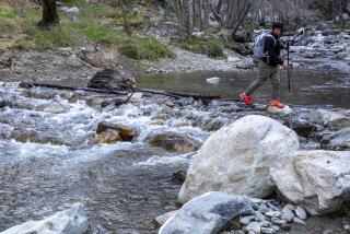
The hike: The signed Deer Springs Trail picks its way through an elfin manzanita forest, then ascends past spreading oaks and tall pines. The trail switchbacks up a ridge to Suicide Junction, 2 miles from the trailhead. Deer Springs Trail continues to junctions with the Pacific Crest Trail and Marion Mountain Trail, but you leave this trail and bear east on a signed side trail. Your path contours across Marion Ridge and you cross Marion Creek, low at this time of year. A long mile from Suicide Junction, you reach the back side of Suicide Rock.
From the white granite rock you will be able to look down and see tiny Idyllwild and Strawberry Valley. On the far horizon is Tahquitz Peak. Sometimes Indian summer thunder and lightning displays add drama to the panorama. Views like this bring hikers back again and again to sample the beauty of the San Jacinto Muntains.
Return the same way.
Deer Springs Trail
Idyllwild to Suicide Rock: 6 1/2 miles round trip; 2,000-foot elevation gain. Wilderness permit required
More to Read
Sign up for The Wild
We’ll help you find the best places to hike, bike and run, as well as the perfect silent spots for meditation and yoga.
You may occasionally receive promotional content from the Los Angeles Times.


