Developments in Brief : Minerals in Desert Point to Rotation
- Share via
Millions of years ago, a several-hundred-square mile area of California’s Mojave Desert rotated clockwise as huge plates of the Earth’s crust moved past each other along the earthquake-prone San Andreas Fault, a NASA study says.
The area includes the entire Antelope Valley and other parts of the Mojave west of U.S. 395, including Edwards Air Force Base and the cities of Lancaster, Palmdale and Mojave, according to geologist Matthew Golombek of the Jet Propulsion Laboratory in Pasadena.
He said the rotation, which occurred between 16 million and 20 million years ago, was about 25 degrees.
The San Andreas Fault is a northwest-southeast swath that divides two great plates of Earth’s crust. The Pacific Plate underlies much of Southern California, the Central California coast and the eastern Pacific Ocean. The North American Plate underlies the rest of California and the continent.
Earthquakes and non-quake motions along the fault occur as the Pacific Plate moves northwest past the North American Plate. Chunks of Earth caught between the two plates can rotate clockwise as one plate moves past the other.
“Think about putting a pencil between your two hands, moving your hands (so the left hand moves upward relative to the right hand), and the pencil will rotate in a clockwise direction,” Golombek said. “That’s what happened to these rocks.”
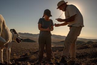
Golombek discovered the rotation by studying the orientation of magnetic minerals in more than 100 samples of 20-million-year-old volcanic rocks he excavated from 19 sites in the Mojave. As the rocks cooled from molten magma, the minerals aligned themselves so they pointed toward magnetic north. Golombek’s study found that the minerals now point 25 degrees to the east of magnetic north, showing that the rocks and underlying crust rotated by that amount.
More to Read
Sign up for Essential California
The most important California stories and recommendations in your inbox every morning.
You may occasionally receive promotional content from the Los Angeles Times.


